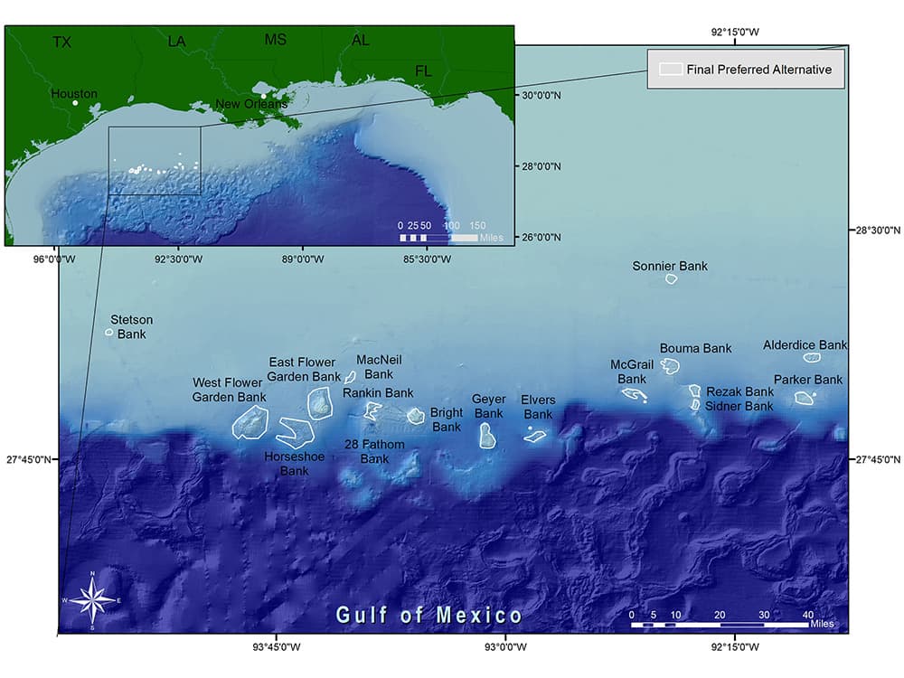
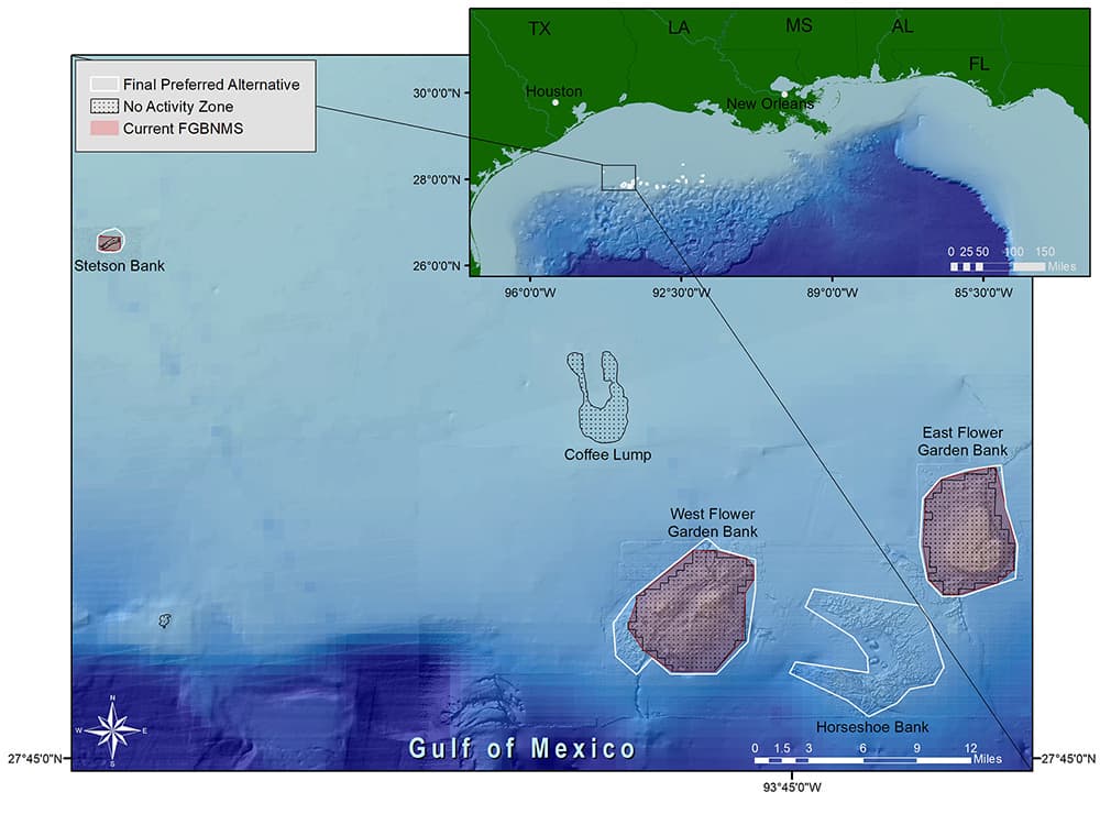
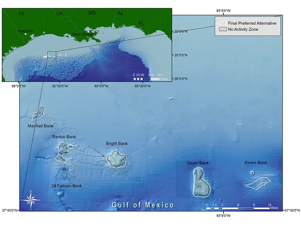
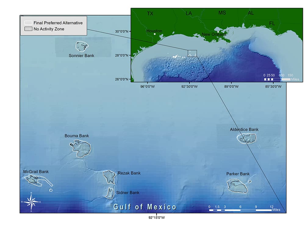
On January 19, 2021, NOAA issued the Final Rule for expansion of Flower Garden Banks National Marine Sanctuary, which took effect March 22, 2021. This action protects 14 additional banks, slightly adjusts the boundaries of the sanctuary's original three banks, and expands the sanctuary from 56 square miles to a total of 160 square miles.
This follows the publication of a Final Environmental Impact Statement (FEIS) on December 11, 2020, which further clarified the expected impacts of the proposed expansion and responded to public comments received throughout the expansion process.
The final rule applies existing sanctuary regulations to all of the new areas, providing protection to limit the impact of activities related to fishing with bottom-tending gear, ship anchoring, oil and gas exploration and production, and salvage on sensitive biological resources.
These areas include critical habitat for recreationally and commercially important fish, as well as threatened or endangered species of manta rays, sea turtles, and corals in the Gulf.
EXPANSION AREAS
| Bank | Size |
|---|---|
| Stetson Bank | 1.4 square miles (3.6 sq km) |
| West Flower Garden Bank | 37.2 square miles (96.4 sq km) |
| Horseshoe Bank | 28.7 square miles (74.3 sq km) |
| East Flower Garden Bank | 27.8 square miles (72 sq km) |
| MacNeil Bank | 2.7 square miles (7 sq km) |
| Rankin/28 Fathom Banks | 5.6 square miles (14.5 sq km) |
| Bright Bank | 7.7 square miles (19.9 sq km) |
| Geyer Bank | 11.5 square miles (29.8 sq km) |
| Elvers Bank | 4.6 square miles (11.9 sq km) |
| McGrail Bank | 4.7 square miles (12.2 sq km) |
| Bouma Bank | 7.7 square miles (19.9 sq km) |
| Sonnier Bank | 3.1 square miles (8.0 sq km) |
| Rezak Bank | 3.7 square miles (9.6 sq km) |
| Sidner Bank | 2.0 square miles (5.2 sq km) |
| Parker Bank | 7.0 square miles (18.1 sq km) |
| Alderdice Bank | 5.0 square miles (13 sq km) |
| TOTAL | 160.4 square miles (415.4 sq km) |
EXPANSION MAPS
Sanctuary Expansion Process
Expansion was identified as a priority for Flower Garden Banks National Marine Sanctuary in 2007 and resulted in an initial recommendation from the Sanctuary Advisory Council. This began a process of scientific analysis, consultation, and public input that would continue for 14 years.
 1. SCOPING
NOAA published a Notice of Intent to consider possible expansion of Flower Garden Banks National Marine Sanctuary in February 2015. NOAA asked the public for input on potential boundaries; resources to be protected; issues NOAA should consider; and any information that should be included in the resource analysis.
 2. PROPOSED EXPANSION
In response to public scoping, NOAA released a Draft Environmental Impact Statement (DEIS) in June 2016. This document analyzed a range of expansion alternatives, and proposed regulations and boundaries. NOAA asked the public, agency partners, and other stakeholders for input on the DEIS during a 60-day public comment period. NOAA considered all input and determined appropriate changes to address this input.
 3. CONSULTATION
The DEIS was presented to the Gulf of Mexico Fishery Management Council for consultation on appropriate regulations for the preferred Alternative 3. The consultation resulted in a recommendation from the Gulf Council in November 2016.
 4. ADVISORY COUNCIL REVIEW & RECOMMENDATION
The 2018 Sanctuary Advisory Council recommendation resulted from an ongoing effort by the sanctuary to work closely with community and stakeholder groups to protect areas of national significance in the Gulf. NOAA evaluated the advisory council’s recommendation and revised the preferred alternative.
 5. CONSULTATIONS
Pursuant to Presidential Executive Order 13795, NOAA requested an analysis from the Department of Interior regarding energy or mineral resource potential within the proposed areas and potential impact of the proposed expansion on the development of those resources. NOAA also continued to coordinate with the Gulf of Mexico Fishery Management Council regarding fishing regulations in the proposed expansion areas. Additional consultations took place with NOAA Fisheries, the Bureau of Ocean Energy Management, the U.S. Coastguard, and the U.S. Navy.
 6. PROPOSED RULEMAKING
NOAA issued a Notice of Proposed Rulemaking in May 2020. NOAA asked the public for input on any aspect of the proposed rule, but also specific input on three items: changes to the proposed boundaries in the revised preferred alternative; a request for an exemption for pelagic longline gear; and a request for a spearfishing exemption.
The public, agency partners, and other stakeholders provided input on the Proposed Rulemaking during a 60-day public comment period. NOAA considered all input and determined appropriate changes to address this input.
NOAA also issued and accepted public comment on a Regulatory Impact Review (RIR) of the proposed expansion of Flower Garden Banks National Marine Sanctuary in November 2020. The RIR was added as a supporting document to the proposed rule for the expansion of the sanctuary.
 7. SANCTUARY EXPANSION
NOAA released a Final Environmental Impact Statement (FEIS) in December 2020 followed by a Final Rule on January 19, 2021. This rule became effective March 22, 2021 after 45 days of continuous Congressional session, during which time Congress had the opportunity to review the final proposal.
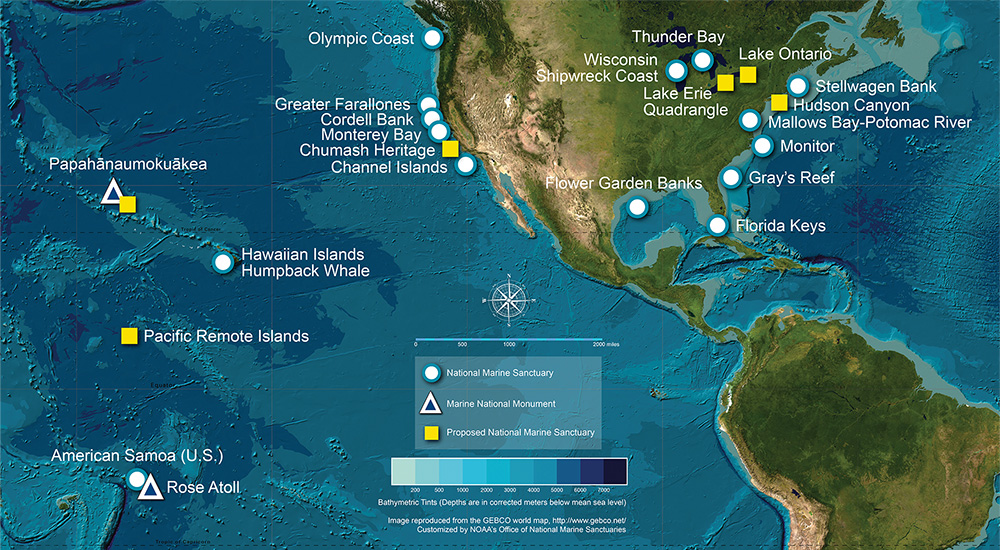
NOAA's National Marine Sanctuary System
The Office of National Marine Sanctuaries serves as the trustee for a network of underwater parks encompassing more than 629,000 square miles of marine and Great Lakes waters. The network includes a system of 18 national marine sanctuaries and two marine national monuments.
Through the National Marine Sanctuaries Act, NOAA can identify, designate and protect areas of the marine and Great Lakes environment that have special national significance.
