school of fish in background
Skip to page Header home about your sanctuary visiting your sanctuary education science management news and events protecting resources image library Get Involved advisory council NOAA logo - a circle with a stylized seabird in flight; background is dark blue above the bird and light blue below the bird.

blank spaceFind us on Facebook

     Follow @fgbnms on Twitter


Image Library

Skip to Main Content
Image Library Home    Species Lists    Maps
Videos    Manta Catalog    Monitoring
Historic Expeditions

SANCTUARY MAPS

The maps on this page show the general location of the sanctuary and its surroundings.

*Click on any map below to see a larger, higher-resolution image.

Additional Map pages:

Sanctuary Banks

Interactive GIS-based Map


SANCTUARY LOCATION

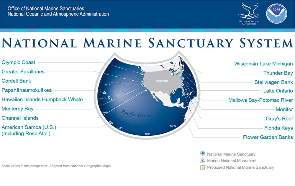
Map showing location of all 15 sites in the National Marine Sanctuary System.  Includes North America and the tropical Pacific.
National Marine Sanctuaries System Map
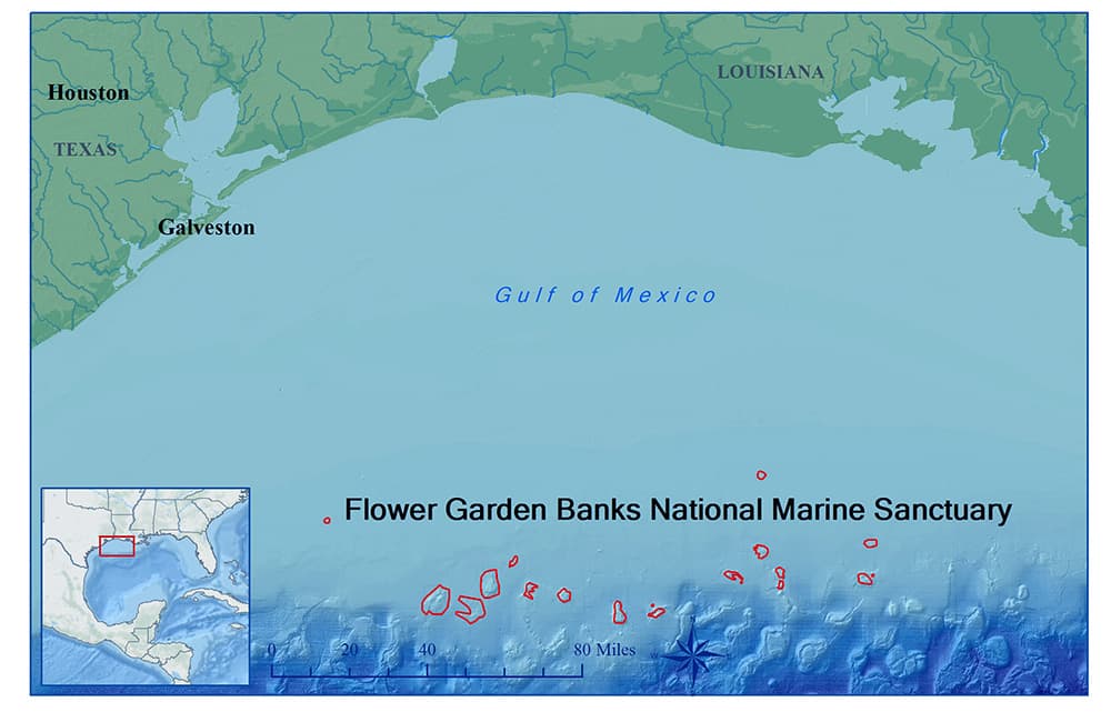
Atlas style map of Flower Garden Banks National Marine Sanctuary.  Inset map shows relative location to coastal United States in the Gulf of Mexico.
FGBNMS Atlas Map

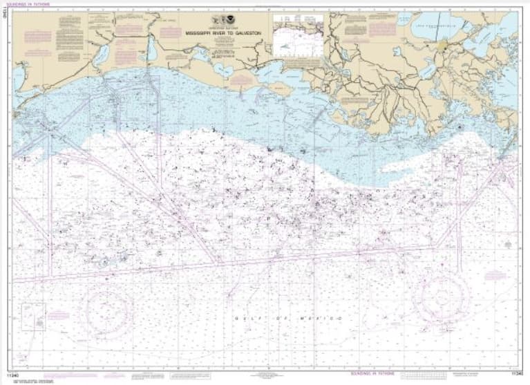
Nautical Chart 11340
NOAA Nautical Chart 11340, which includes Flower Garden Banks National Marine Sanctuary

View NOAA Chart 11340 in NOAA's Online Chart Catalog

Download PDF of NOAA Chart 11340
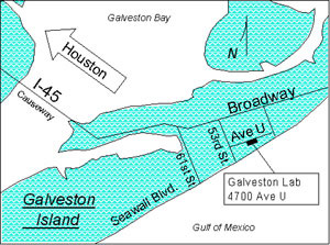
Map showing location of sanctuary office in Galveston, TX
FGBNMS Office Location in Galveston, TX
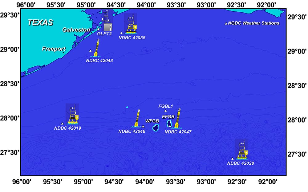
Map showing weather and data buoy locations in relation to the sanctuary.
Weather and Data Buoys near FGBNMS (559kb jpg)

For more information on weather and data buoys near the sanctuary, please visit our Weather Buoy page.
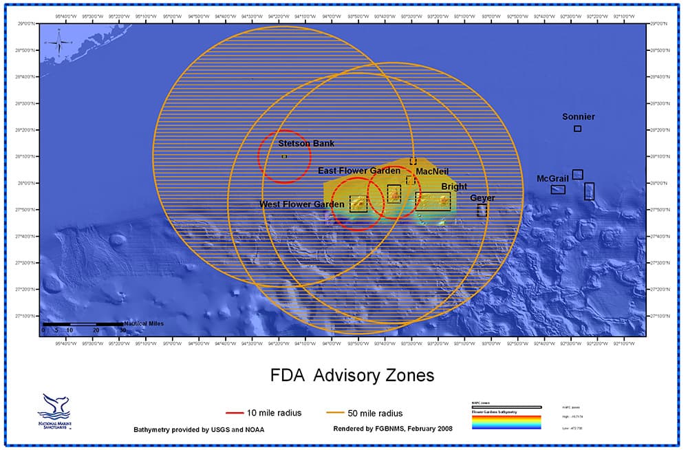
Map showing FDA advisory zones for ciguatera toxin in fish in the vicinity of the Flower Garden Banks
FDA Advisory Zones for Ciguatera Toxin in Fish

For additional information on the FDA Advisory regarding ciguatoxins in Gulf fish species, please visit our Ciguatera Information.

top of page

MANAGEMENT ZONES

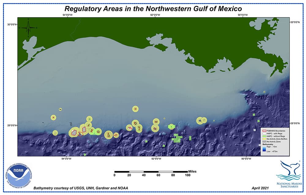
Map of northwestern Gulf of Mexico showing HAPCs, Coral HAPCs, No Activity Zones (NAZ), NAZ Buffer Zones, and sanctuary boundaries
Regulatory areas in the northwestern Gulf of Mexico
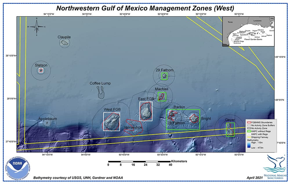
Map showing management zones in the western portion of the northwestern Gulf of Mexico
A closer look at the Management Zones in the western section of the northwestern Gulf of Mexico
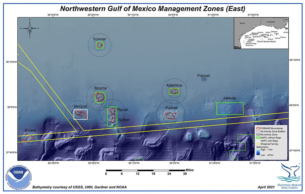
Map showing management zones in the eastern portion of the northwestern Gulf of Mexico
A closer look at the Management Zones in the eastern section of the northwestern Gulf of Mexico

For additional information on the management zones in the northwestern Gulf of Mexico, please visit our Management Zones page.
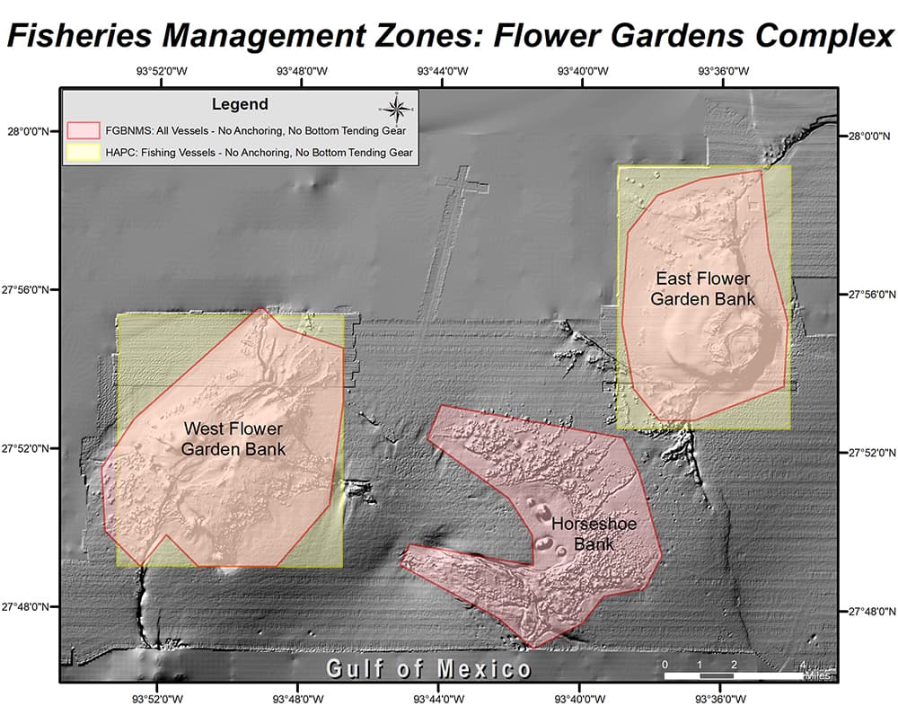
Map showing the Coral Habitat Areas of Particular Concern (HAPCs) and sanctuary boundaries at the Flower Garden and Horseshoe Banks
Fisheries Management zones around East and West Flower Garden Banks
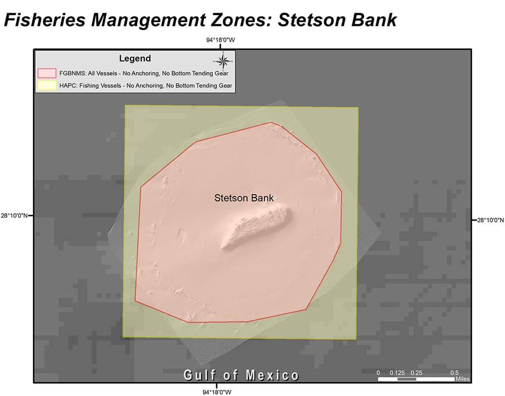
Map showing the Coral Habitat Areas of Particular Concern (HAPCs) and sanctuary boundaries at Stetson Bank
Fisheries Management zones around Stetson Bank
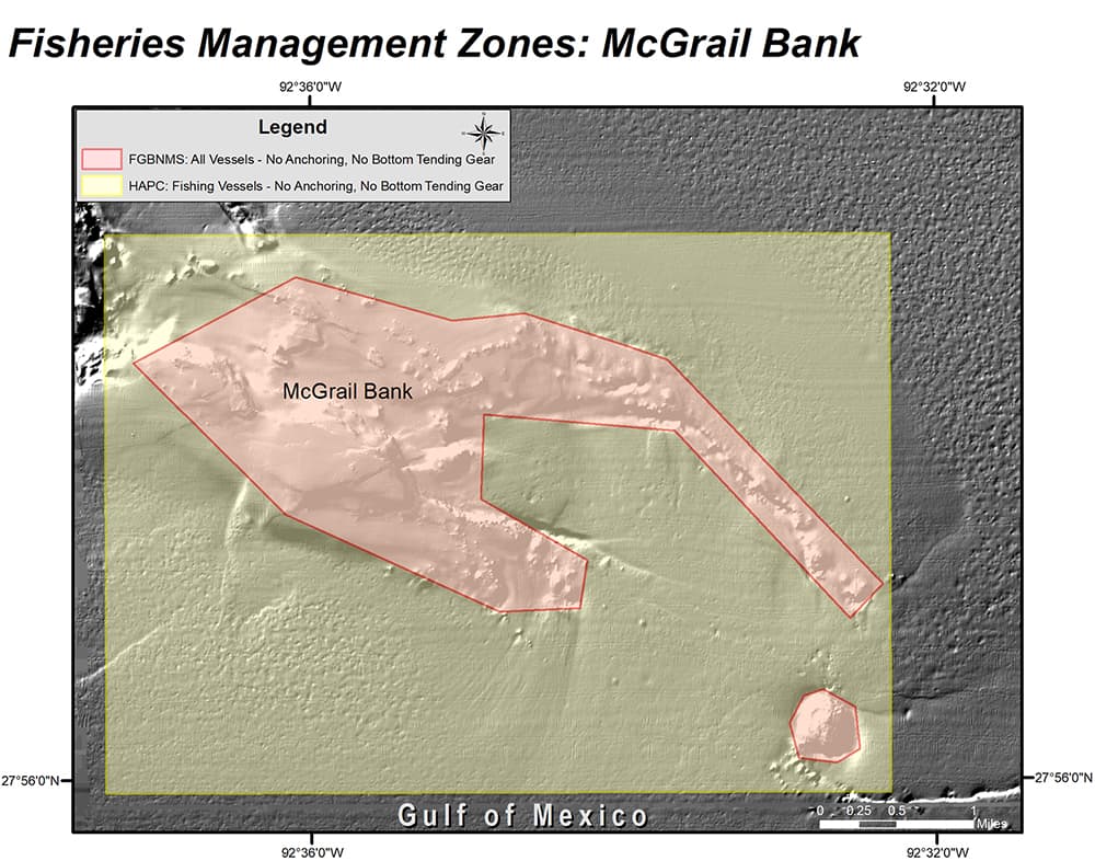
Map showing the Coral Habitat Areas of Particular Concern (HAPCs) and sanctuary boundaries at McGrail Bank
Fisheries Management zones around McGrail Bank

top of page

WATER FLOW

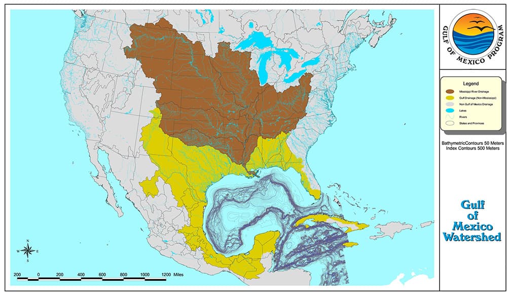
Map showing the North American watershed that leads to the Gulf of Mexico
Gulf of Mexico Watershed
Image Credit: EPA

For more information about the Gulf of Mexico watershed, please visit our Natural Setting page.
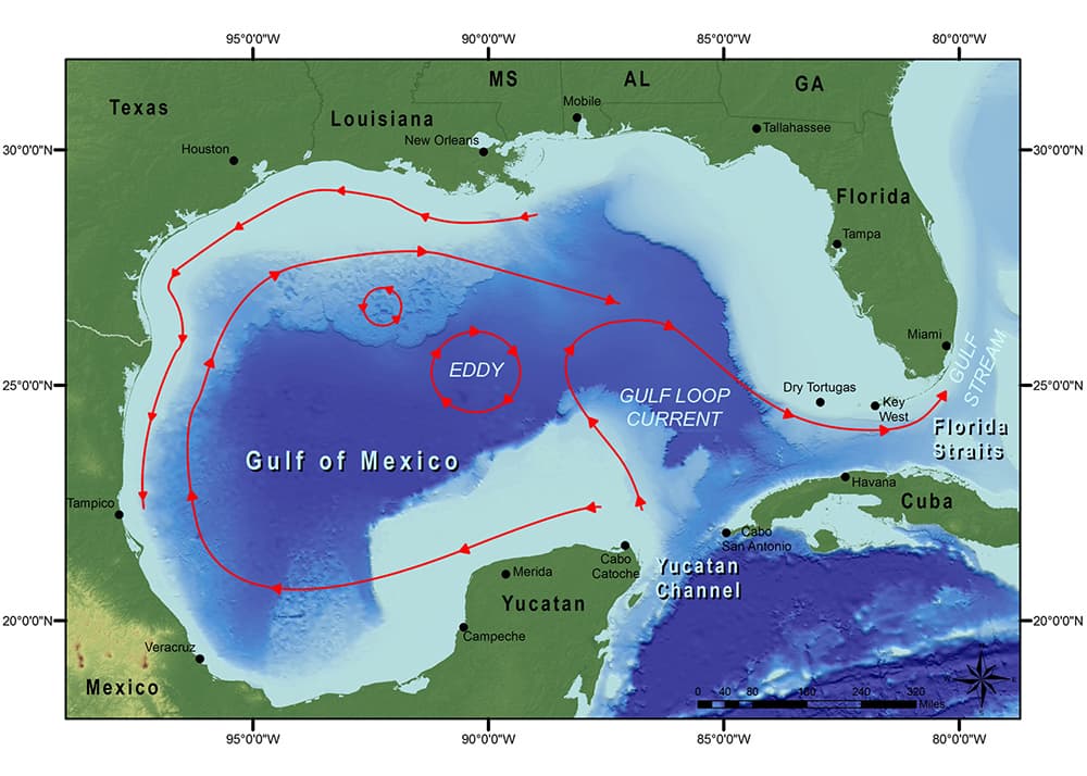
Map showing current patterns in the Gulf of Mexico
Basic current patterns in the Gulf of Mexico,
including the Loop Current

For more information about how current movement in the Gulf of Mexico affects Flower Garden Banks National Marine Sanctuary, please visit our Natural Setting web page.

top of page


weather report observations cool stuff get wet


Juvenile blue tang (fish).  Bright yellow body with irridescent blue marking around eye and at top edge of dorsal fin.
   
National Marine Sanctuary logo - a stylized whale tail above waves