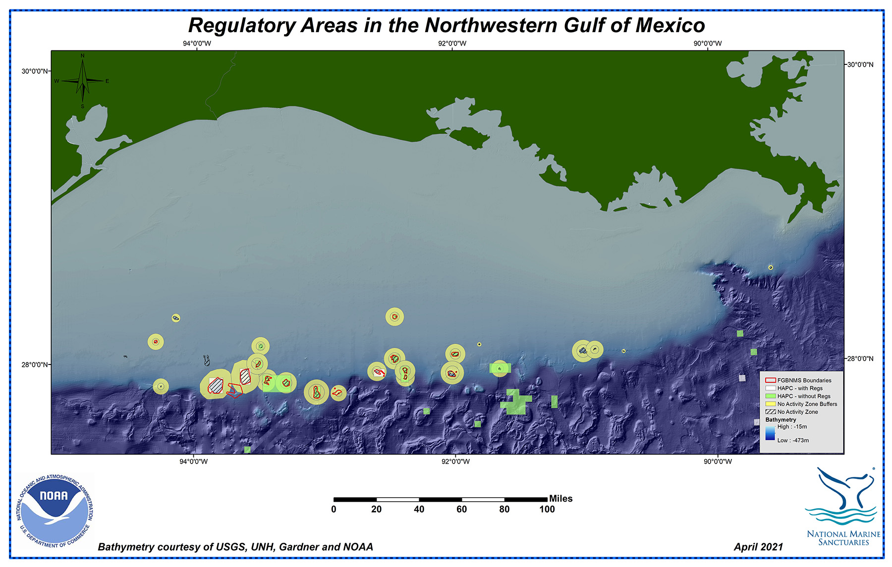
National Marine Sanctuary status isn't the only type of habitat protection found in the northwestern Gulf, although it is the most comprehensive. Many of the reefs and banks have industry-specific protections through the Bureau of Ocean Energy Management (BOEM) and NOAA Fisheries.
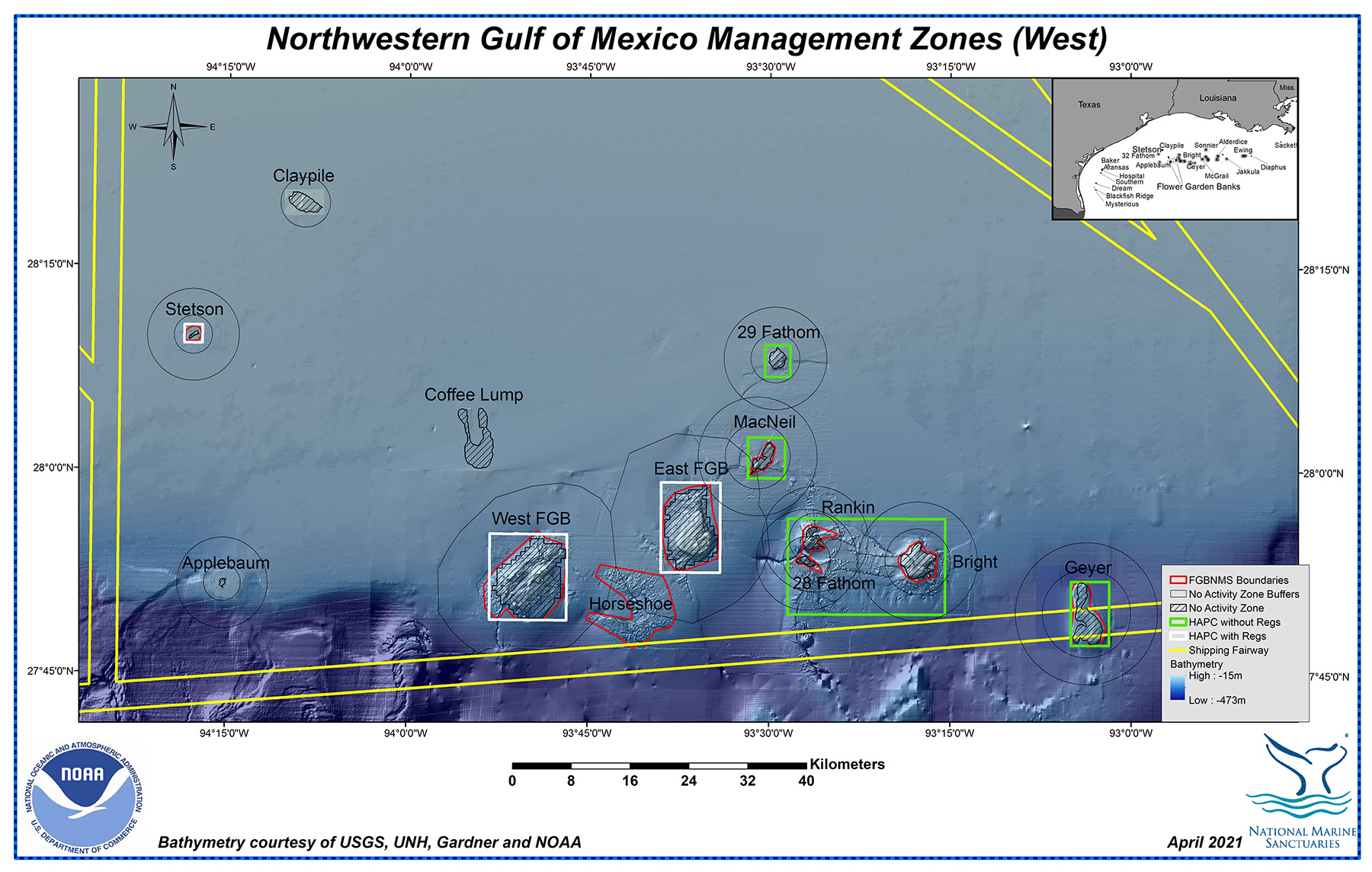
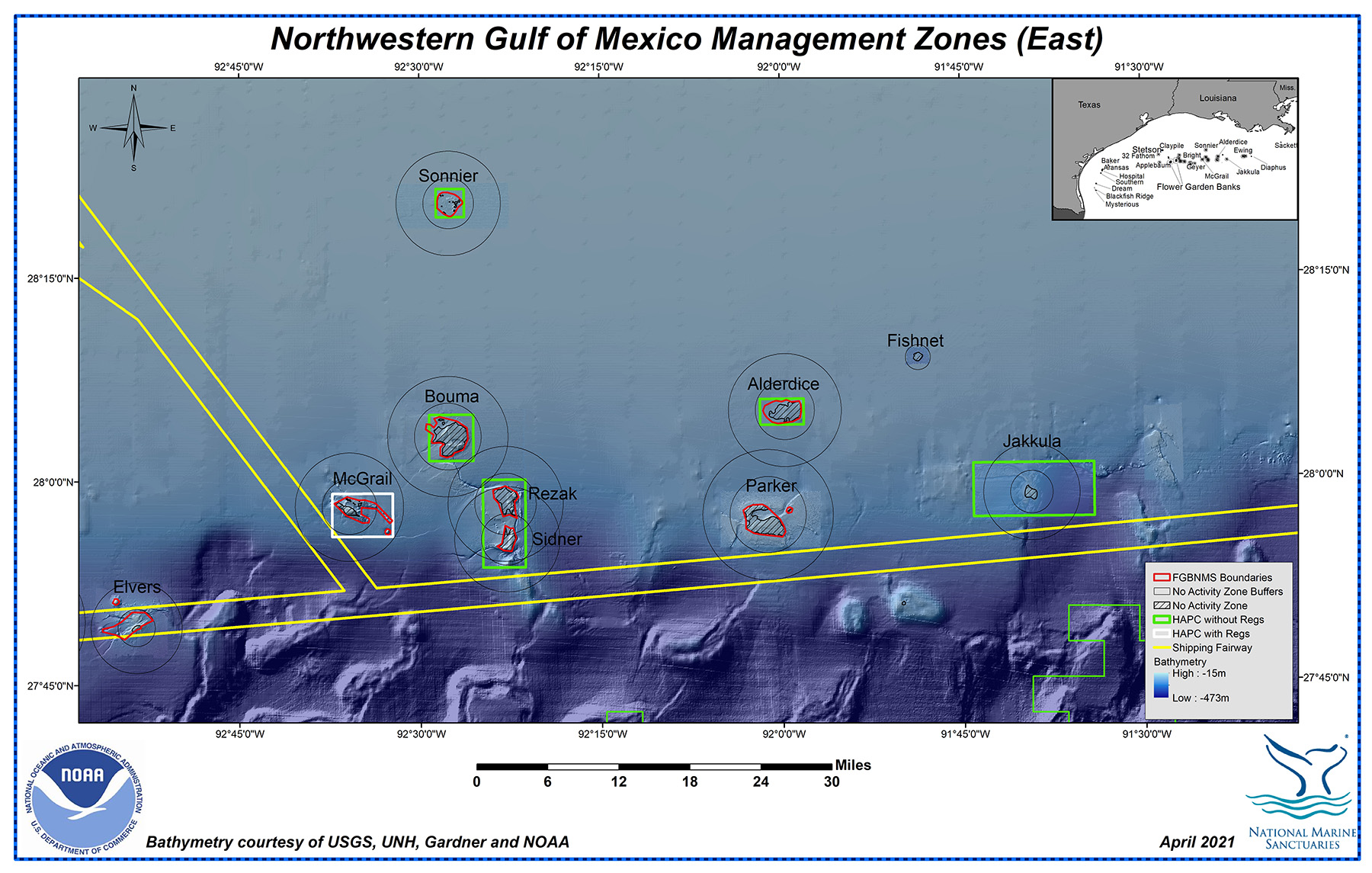
No Activity Zone (NAZ)
BOEM regulates the oil and gas industry in regards to their interaction with the reefs and banks through Topographic Features Stipulations, which establish No Activity Zones (NAZ) at the topographic features. Many of the sanctuary boundaries lie in close proximity to the NAZs at each of the banks.
No Activity Zones apply only to the oil and gas industry.
Habitat Area of Particular Concern (HAPC)
Several of the reefs and banks in the region have also been designated as Habitat Areas of Particular Concern (HAPC), a subset of NOAA Fisheries Essential Fish Habitat (EFH). These areas are identified by the regional fishery management council as priorities for habitat conservation, management, and research.
Although the HAPC designation on its own does not carry any protective measures, it identifies the site as an area for special consideration during individual fish species assessments and requires consultations on non-fishing activities that may have adverse impacts on fish habitat.
An area may be designated as an HAPC due to:
- The importance of the ecological function provided by the habitat.
- The extent to which the habitat is sensitive to human-induced environmental degradation.
- Whether, and to what extent, development activities are, or will be, stressing the habitat type.
- The rarity of the habitat type.
Coral HAPC
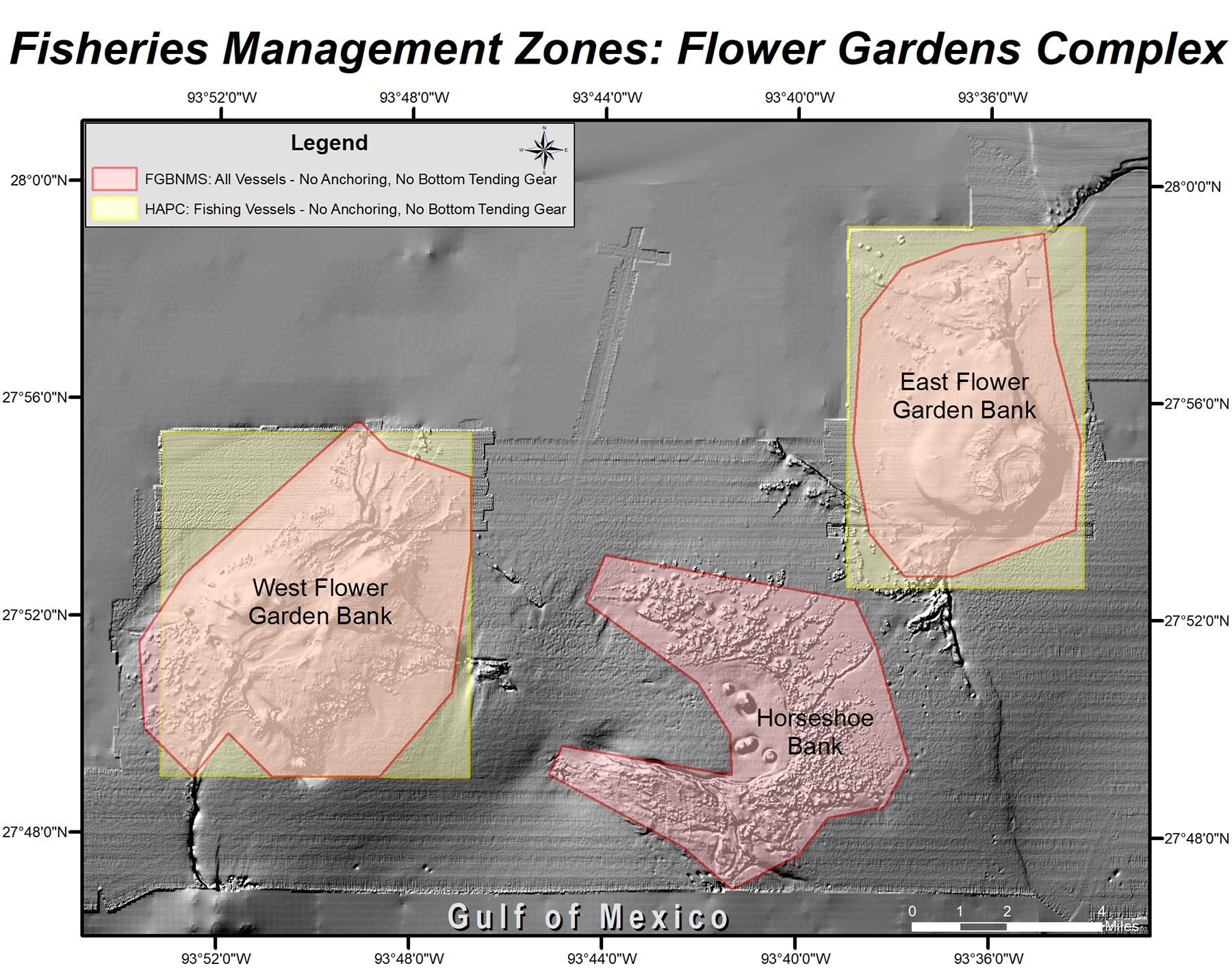
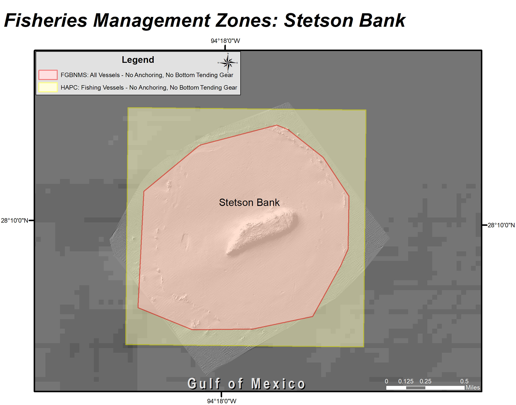
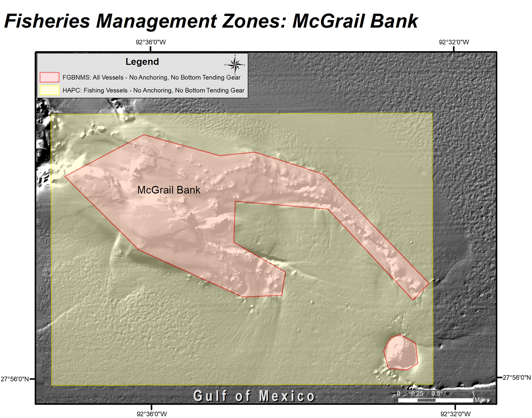
An additional level of designation, a Coral HAPC, does carry regulations that specifically prohibit fishing vessels from using bottom longlines, bottom trawling, buoy gear, pots or traps, and bottom anchoring. In the northwestern Gulf, East Flower Garden Bank, West Flower Garden Bank, Stetson Bank, and McGrail Bank carry this designation, in addition to being part of the sanctuary.
More information on this type of designation can be found in the Coral HAPC Explorer from the Gulf of Mexico Fishery Management Council.
Coral HAPC regulations apply only to fishing vessels, while sanctuary regulations prohibit anchoring and the use of bottom tending gear for all vessels. See the maps below for clarification.
In other words, sanctuary regulations are more restrictive than Coral HAPC regulations.