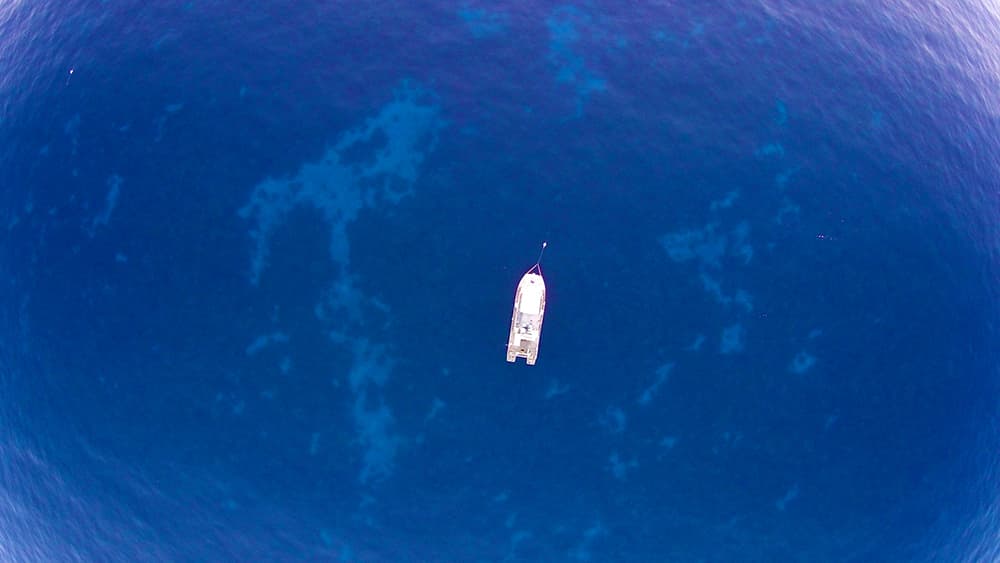
Whether you will be spending a weekend diving or fishing at Flower Garden Banks National Marine Sanctuary, or just stopping by to rest for an evening, please remember that anchoring is not permitted within sanctuary boundaries.
The sanctuary provides mooring buoys at Stetson, East Flower Garden, West Flower Garden, Bright, Geyer, and Rezak Banks to ensure vessels have a safe way to visit these areas without damaging the fragile reef communities below.
Proper Use of Mooring Buoys
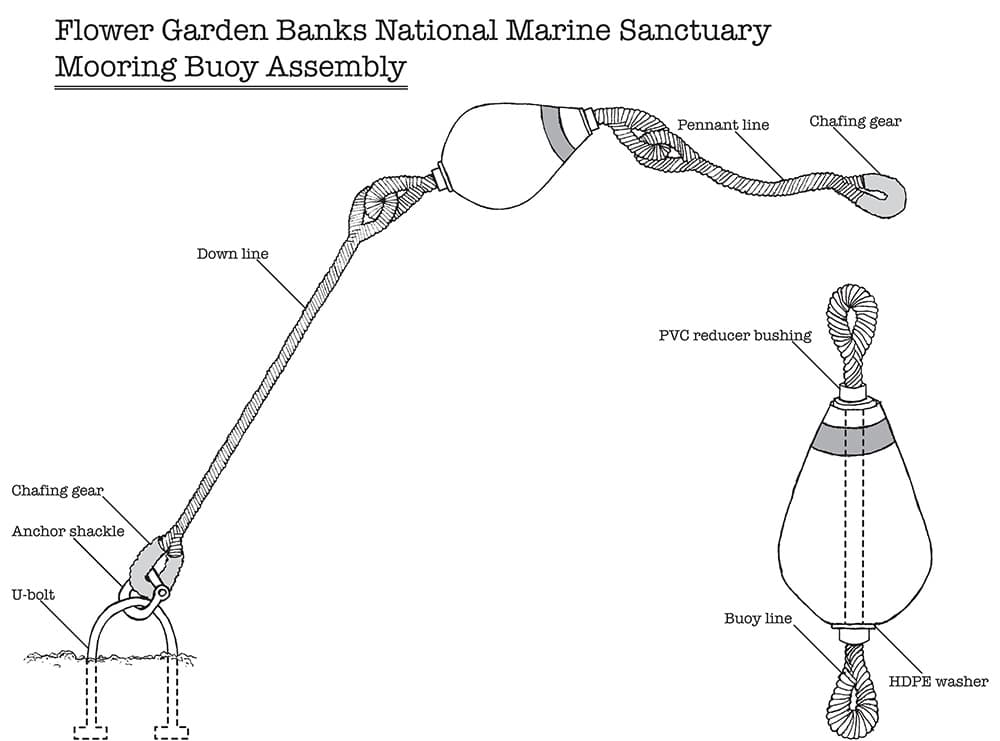
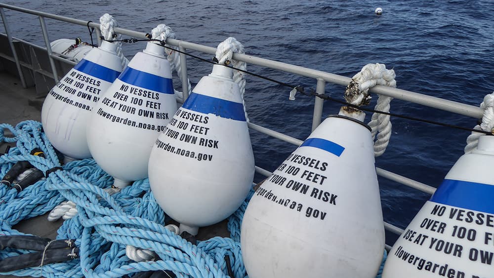
Sanctuary mooring buoys are designed for use by vessels up to 100 feet in length. Each buoy is anchored to the sea floor by a long line attached to a large, metal u-bolt cemented into reef rock. A floating pennant line is attached to the top of the buoy to provide a mooring point for vessels.
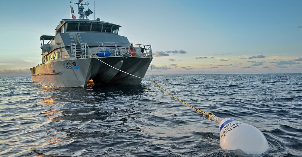
When using a mooring buoy, it is best to pass a line from the bow of the vessel through the pennant line and back to the vessel to create a bridle. This bridle greatly reduces stress on the mooring, and offers a more comfortable ride for the vessel.
Mooring buoys are available on a first come, first served basis.
Mooring Design
The mooring design was modeled after those used in Florida Keys National Marine Sanctuary, and modified to be able to accommodate larger vessels in a deeper environment. While these moorings are durable and inspected frequently, improper use can lead to increased damage and frequency of replacement.
In the event you find a damaged mooring when visiting the sanctuary, please notify us at flowergarden@noaa.gov at your earliest convenience.
Mooring Buoy Locations
Mooring buoys may be removed for maintenance or disappear during severe storms, so they may not all be there when you are. Please report missing buoys to flowergarden@noaa.gov at your earliest convenience.
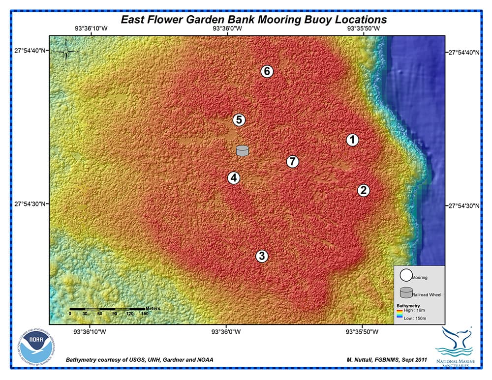
| Buoy # | Latitude (DD) | Longitude (DD) | Depth (ft/m) |
|---|---|---|---|
| 1 | 27.909517 | -93.597417 | 64ft / 20m |
| 2 | 27.9086 | -93.597183 | 63ft / 19m |
| 3 | 27.9074 | -93.59925 | 65ft / 20m |
| 4 | 27.908817 | -93.599833 | 61ft / 19m |
| 5 | 27.909867 | -93.599733 | 70ft / 21m |
| 6 | 27.91075 | -93.599167 | 65ft / 20m |
| 7 | 27.909117 | -93.598633 | 63ft / 19m |
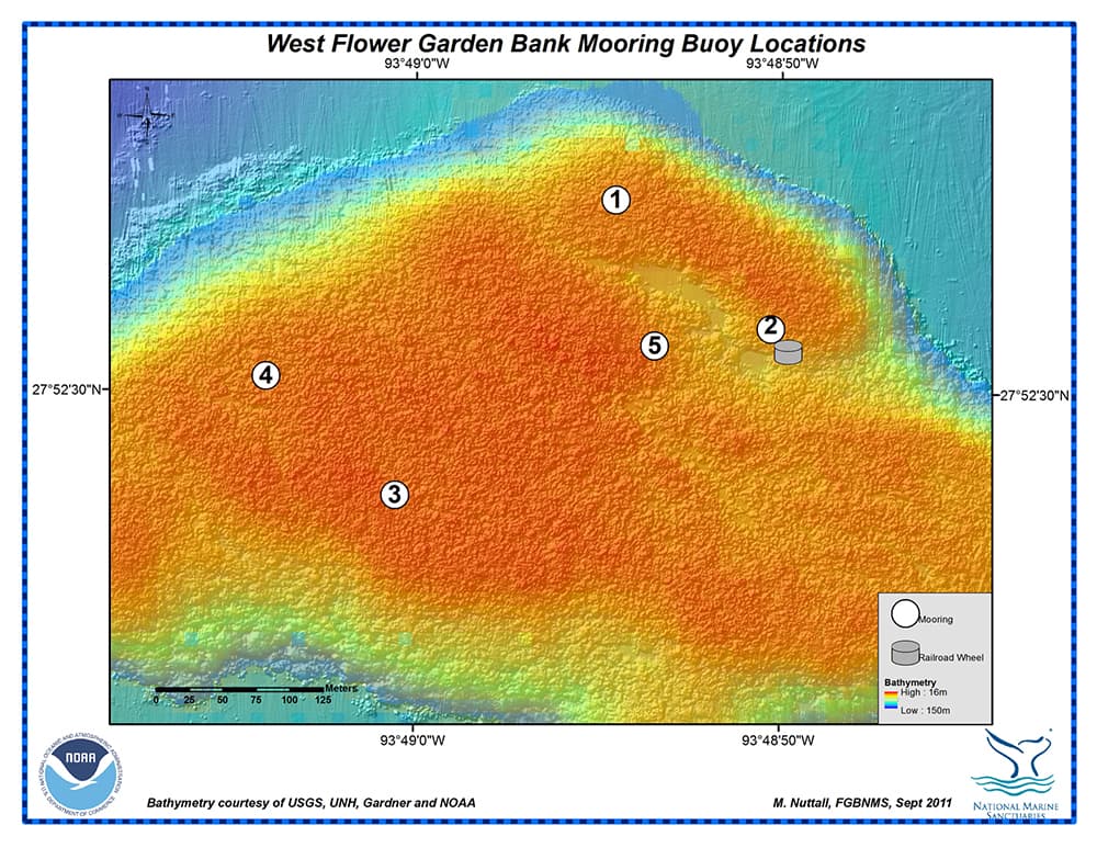
| Buoy# | Latitude (DD) | Longitude (DD) | Depth (ft/m) |
|---|---|---|---|
| 1 | 27.8763 | -933815117 | 78ft / 24m |
| 2 | 27.875433 | -93.813933 | 80ft / 24m |
| 3 | 27.8743 | -93.816783 | 80ft / 24m |
| 4 | 27.8751 | -93.817767 | 75ft / 23m |
| 5 | 27.875317 | -93.814817 | 68ft / 21m |
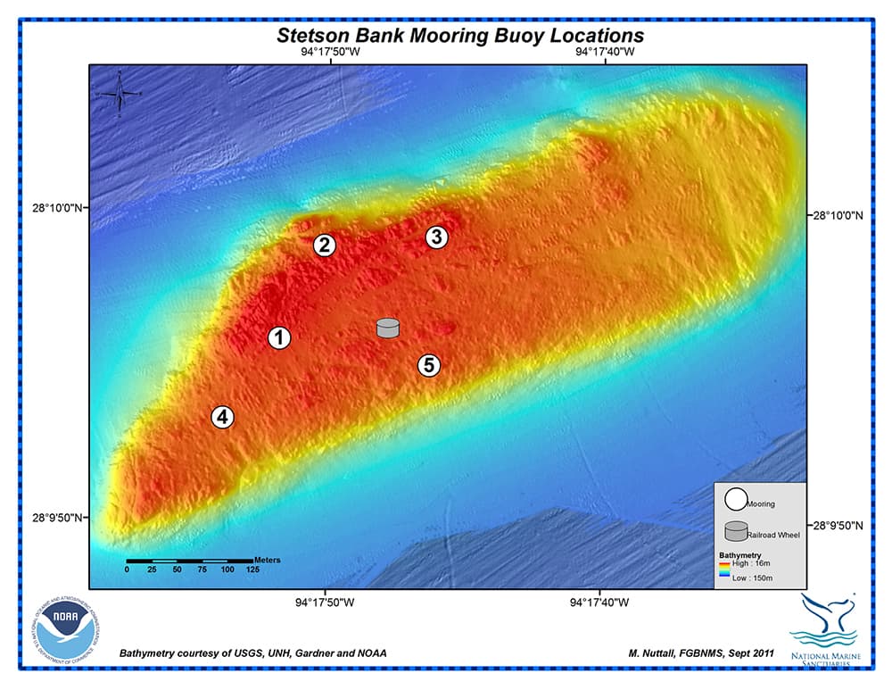
| Buoy# | Latitude (DD) | Longitude (DD) | Depth (ft/m) |
|---|---|---|---|
| 1 | 28.165517 | -94.297683 | 74ft / 23m |
| 2 | 28.16635 | -94.297233 | 78ft / 24m |
| 3 | 28.166433 | -94.2961 | 73ft / 22m |
| 4 | 28.1648 | -94.29825 | 85ft / 26m |
| 5 | 28.165283 | -94.296167 | 79ft / 24m |
| Buoy# | Latitude (DD) | Longitude (DD) | Depth (ft/m) |
|---|---|---|---|
| 1 | 27.89511 | -93.30702 | 159ft / 48m |
| 2 | 27.89503 | -93.30497 | 143ft / 44m |
| Buoy# | Latitude (DD) | Longitude (DD) | Depth (ft/m) |
|---|---|---|---|
| 1 | 27.84792 | -93.06492 | 106ft / 32m |
| 2 | 27.84795 | -93.06688 | 256ft / 78m |
| Buoy# | Latitude (DD) | Longitude (DD) | Depth (ft/m) |
|---|---|---|---|
| 1 | 27.97198 | -92.37944 | 235ft / 72m |
| 2 | 27.97965 | -92.36861 | 194ft / 59m |


