McGrail Bank
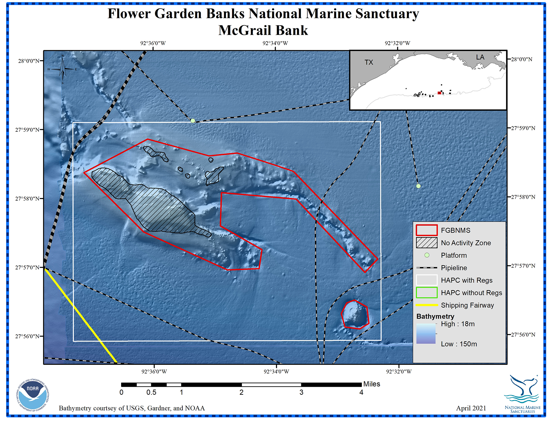
Bottom Depth Range: 144-512 feet (44-156 meters)
Distance from Land: 109 miles (175 km)
Area: 4.7 square miles (12.2 sq km)
McGrail Bank (formerly known as 18 Fathom Bank) features areas of coral reefs dominated by large colonies of the blushing star coral, Stephanocoenia intersepta. No other coral reef is known to be dominated by this species. Other reef-building corals are also present, but in smaller numbers. In some areas, the overall coral cover is as high as 28%.
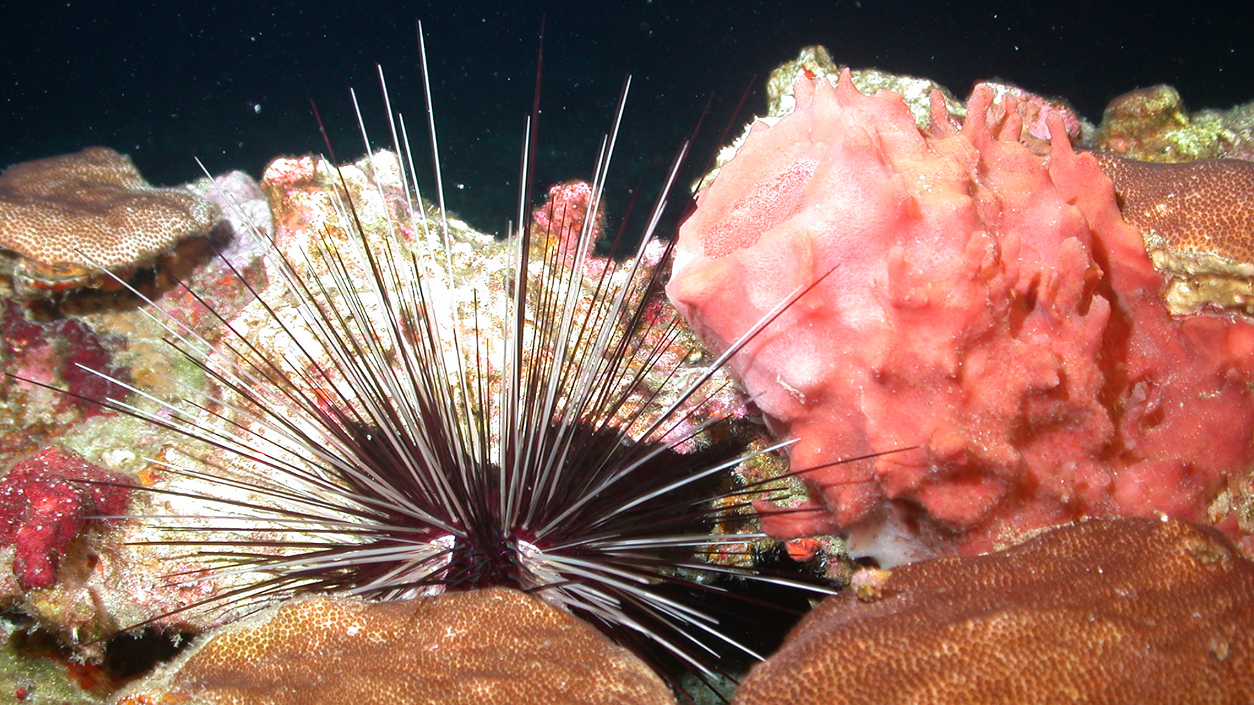
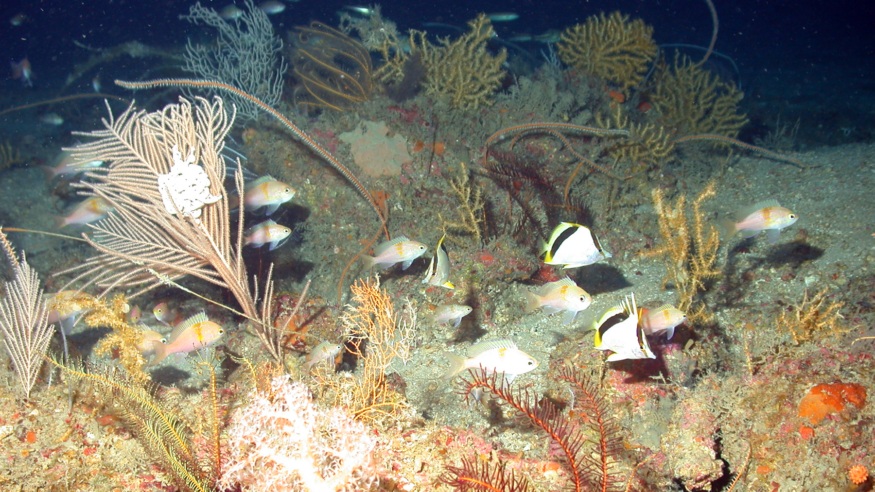
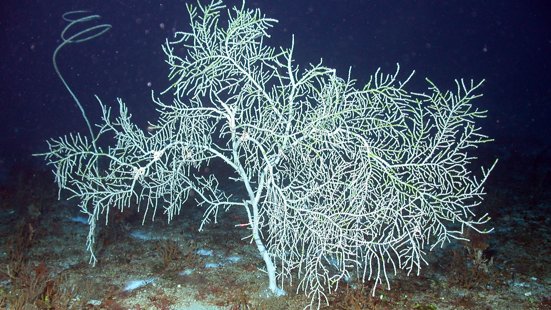
The deeper portions of the bank include mesophotic coral communities featuring black corals, octocorals, fish, sponges, algae, and invertebrates. McGrail Bank is also designated as a Coral Habitat Area of Particular Concern (HAPC), which includes regulations protecting the bottom habitat from anchoring and the use of bottom tending gear by fishing vessels even outside sanctuary boundaries.
McGrail Bank was named after David W. McGrail, an oceanographer with Texas A&M University and the U.S. Coast Guard.
Video
The following video is a compilation of footage taken during ROV (remotely operated vehicle) and manned submersible explorations at McGrail Bank.
0:00 A bathymetric map of McGrail Bank followed by a second map showing the actual exploration tracks that the ROV and submersible traveled to acquire the following footage in an area about 180-200 feet deep (24-61 meters).
0:18 A small, one-person submersible sitting on the bottom at various locations, large groups of creolefish milling about in almost every part of the reef, coral and sponge areas, sponge and algae areas, grouper, snapper, blue chromis, reef butterflyfish, creole wrasse, rock beauty, large school of yellow goatfish, squirrelfish, large coral mounds, rubble and algae area, horseye jacks, submersible above the reef.
2:12 Creolefish swimming over reef and sand/rubble. Closeup views of a large, lacy-looking leafy algae, a small hermit crab feeding alongside the algae, and a variety of fish surrounding the glass dome of a submersible with a person inside.
2:40 Submersible turning above the reef then continuing with ling, Spanish hogfish and jacks swimming around it.
2:55 Discarded barrel on the reef, encrusted with organisms. Longspine squirrelfish and yellow goatfish swimming nearby. School of creolefish swimming above the reef.
3:10 Algal nodule zone transitioning to a leafy algae area with schools of slender, silvery fish swimming above.
3:24 Large school of creole wrasse and a few creolefish swimming above the reef.
3:32 Sea star on the bottom with brown chromis, spotfin hogfish, a dog snapper and creolefish swimming nearby.
3:39 Sandbar shark cruising across the reef with some jacks.
3:45 Close up view of a marbled grouper with creolefish and a pair of reef butterflyfish.
Video Length: 3:56
Credit: FGBNMS
Who Was David W. McGrail?
David McGrail (1944-1984), was a Texas A&M and U.S. Coast Guard oceanographer. McGrail worked closely with Dick Rezak and Tom Bright to explore the reefs and banks of the northwestern Gulf, resulting in several definitive publications on the subject.
One of the most referenced of their publications is Reefs and Banks of the Northwestern Gulf of Mexico, published in 1985 to share the results of the Bureau of Land Management (BLM) Topographic Features Study conducted in the northwestern Gulf.