Building on more than 30 years of studies and numerous reports released in the last decade calling for additional protections, NOAA’s Flower Garden Banks National Marine Sanctuary released a Draft Environmental Impact Statement (DEIS) proposing to expand its boundaries to protect additional areas of national significance off the coasts of Texas and Louisiana in the Gulf.
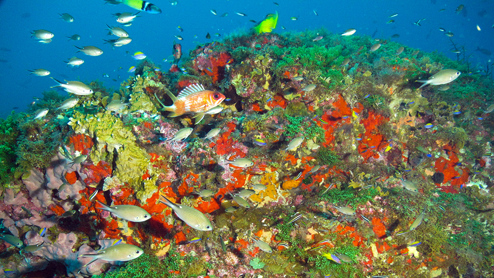
Bright Bank, just to the east of the Flower Garden Banks, features an algal/sponge community typical of many shallower bank areas. Image: FGBNMS/UNCW-UVP
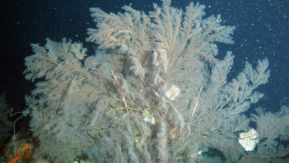
Large black corals are found throughout deep reef habitats of the north central Gulf. Image: FGBNMS/UNCW-UVP
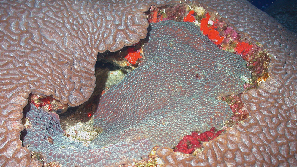
McGrail Bank habitat includes some large coral colonies like those seen at East and West Flower Garden Banks. Image: FGBNMS/UNCW-UVP
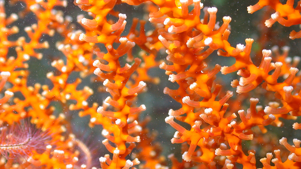
Colorful deep corals provide important habitat throughout the north central Gulf. Image: FGBNMS/UNCW-UVP
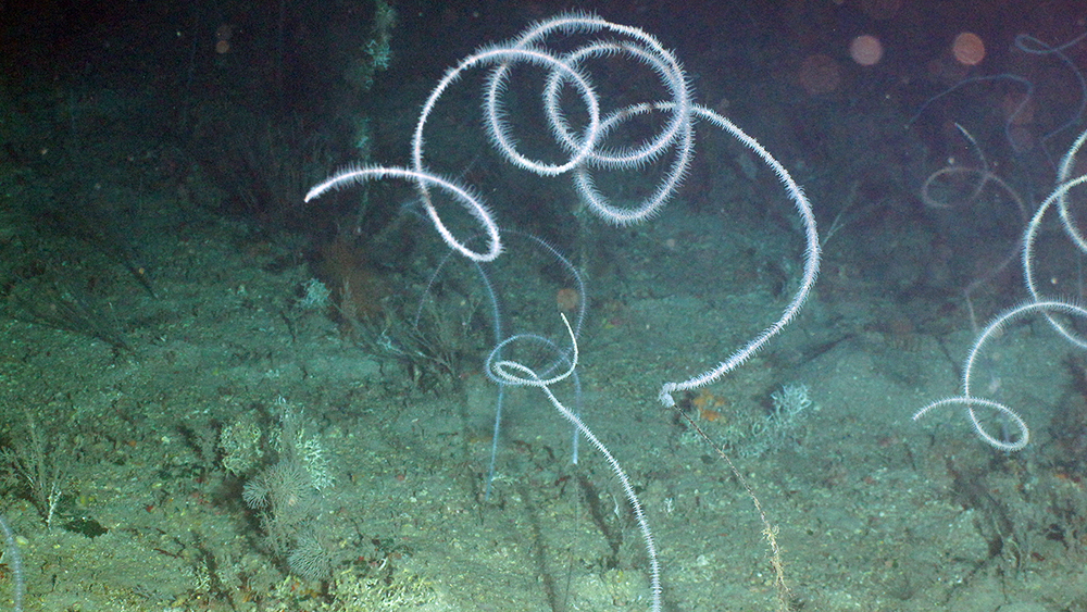
Curly whip corals are common throughout deeper areas of the north central Gulf. Image: FGBNMS/UNCW-UVP
NOAA's DEIS proposed to add 15 additional banks, ranging from 80 to 138 miles off-shore, that are comprised of approximately 383 square miles of reefs and bottom features that provide habitat for fish and other biological resources that serve as engines of sustainability for much of the Gulf.
NOAA also proposed extending the existing protections of Flower Garden Banks National Marine Sanctuary to these additional areas to limit the impact of bottom-disturbing activities on their sensitive biological resources and geological features.
Why Expand?
In 2016, Flower Garden Banks National Marine Sanctuary protected only three among dozens of reefs and banks scattered along the edge of the continental shelf of the northern Gulf.
The Draft Environmental Impact Statement (DEIS) proposed expanding the network of protected areas within FGBNMS by incorporating additional nationally significant reefs and banks in the northern Gulf. The proposed expansion alternatives would provide for more comprehensive management and protection of important habitat sites and cultural resources, and would provide opportunities for research and recovery of resources from observed impacts.
Expanding FGBNMS also supports several important aspects of Deepwater Horizon-related and wider Gulf habitat restoration. In the Gulf of Mexico Ecosystem Restoration Task Force’s “Gulf of Mexico Regional Ecosystem Restoration Strategy,” the FGBNMS region is specifically mentioned as one of the critical areas that should be protected and managed as part of a network of ecologically significant offshore sites to enhance the Gulf’s overall biological productivity and resilience.
In the following video, shared with permission from Sir Patrick Pictures, Sanctuary Superintendent G.P. Schmahl explains the expansion proposal and the alternatives outlined below. (Video Length: 14:41)
Video transcript (162kb pdf)
Expansion Alternatives
The DEIS contains five alternatives that were developed to meet the goals and objectives established by the Sanctuary Advisory Council and comments received during public scoping for sanctuary expansion. NOAA's preferred alternative is Alternative 3.
During development of the DEIS, sanctuary staff worked closely with constituents, particularly the oil and gas and fishing industries. Additionally, BOEM and BSEE participated in development of the DEIS as Cooperating Agencies.
For a full explanation of the proposal details, download the Draft Environmental Impact Statement (DEIS) for Sanctuary Expansion and the associated Appendices:
DEIS: Sanctuary Expansion, Volume I, Chapters 1-6 (9MB pdf)
DEIS: Sanctuary Expansion, Volume II, Appendices (35MB pdf)
A brief summary of the five alternatives is provided below:
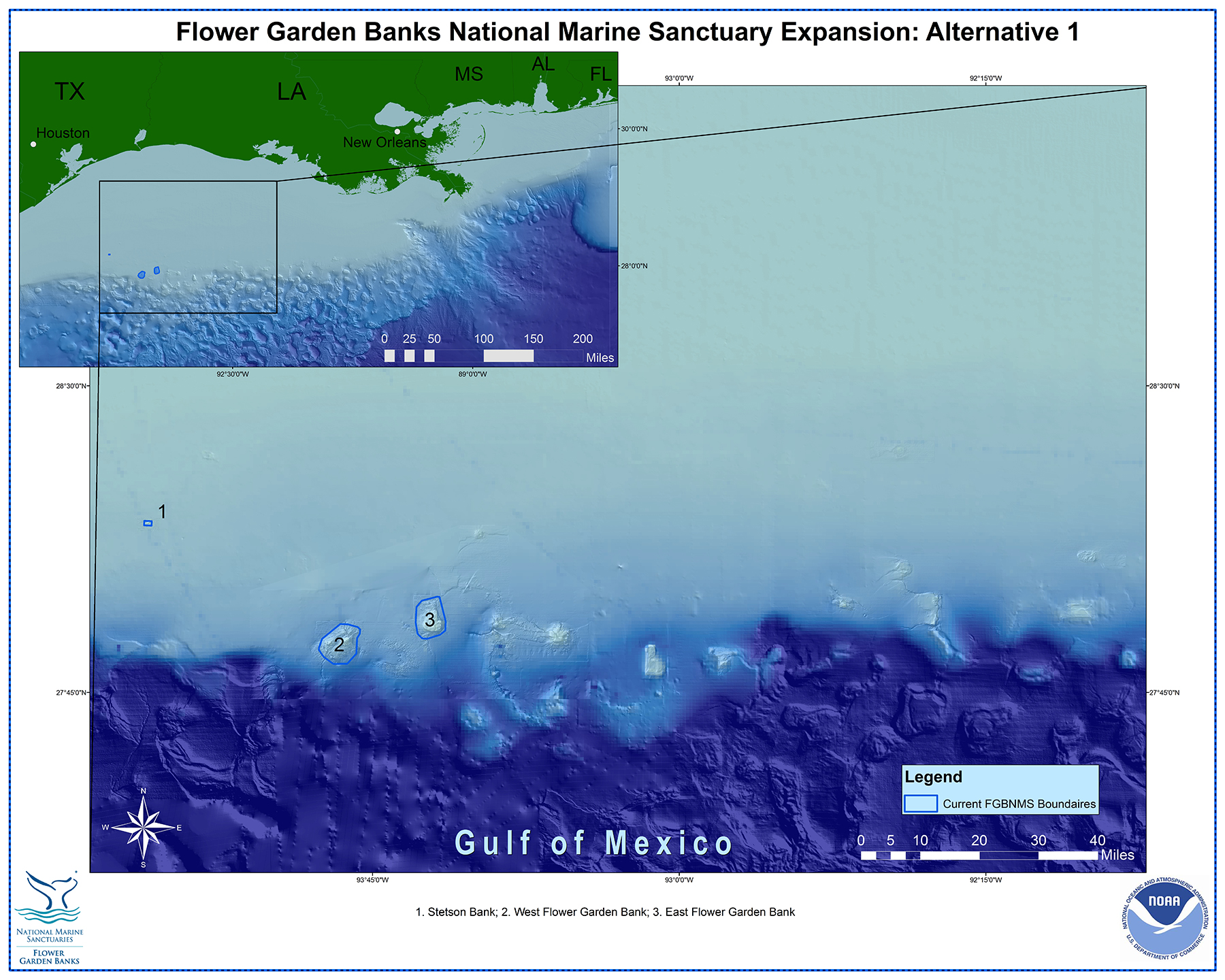
Alternative 1
No action alternative, which maintains the existing FGBNMS boundaries, which encompass ~56 square miles and include 3 distinct geologic features and biological communities at East Flower Garden Bank, West Flower Garden Bank and Stetson Bank. (Click on map for larger view)
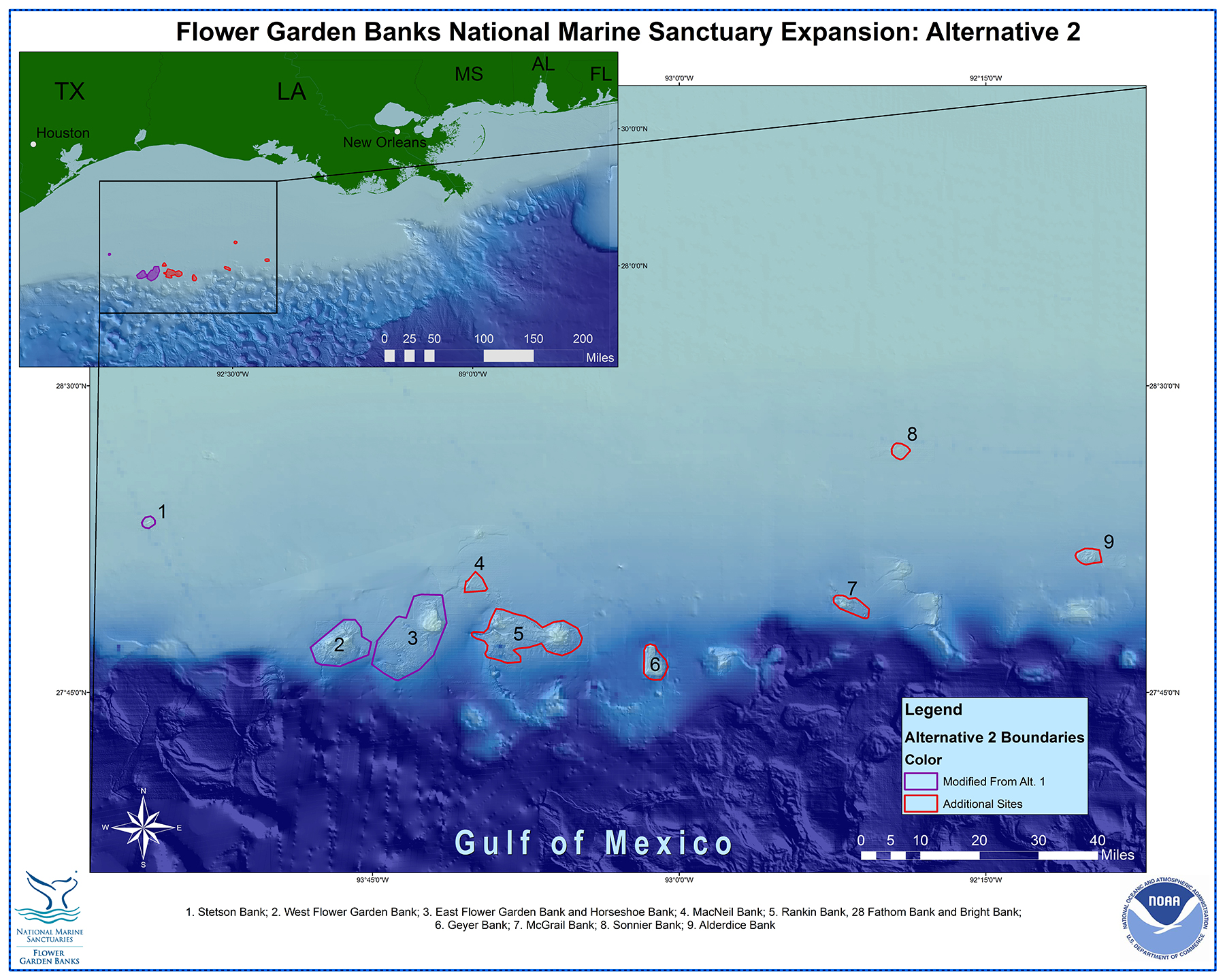
Alternative 2
Sanctuary Advisory Council recommendation made in 2007, encompassing a total of ~281 square miles. This alternative includes 12 nationally significant natural features within 9 discrete proposed boundary areas. (Click on map for larger view)
Alternative 1
Features Included
Total Area
~56 square miles
Discrete Boundaries
3
Alternative 2
Features Included
Total Area
~281 square miles
Discrete Boundaries
9
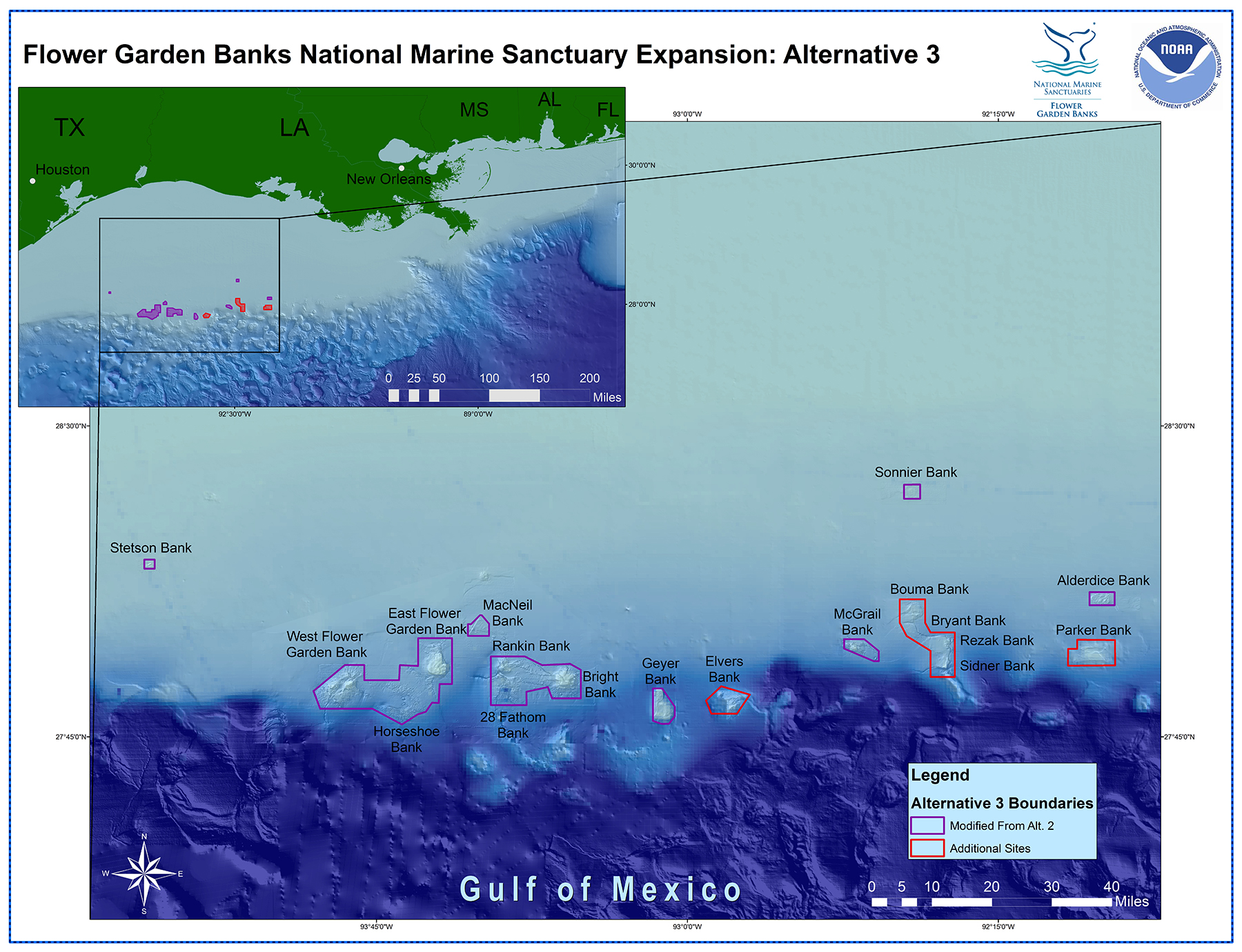
Alternative 3 - Preferred Alternative
The preferred alternative, which is a modified version of the Advisory Council recommendation. This alternative takes into account new information gained since the Advisory Council recommendation was made, simplifying the recommended boundaries for ease of enforcement and consistency with existing regulatory regimes, and encompassing ~383 square miles. This alternative includes a total of 18 nationally significant natural features within 11 discrete proposed boundary areas. (Click on map for larger view)
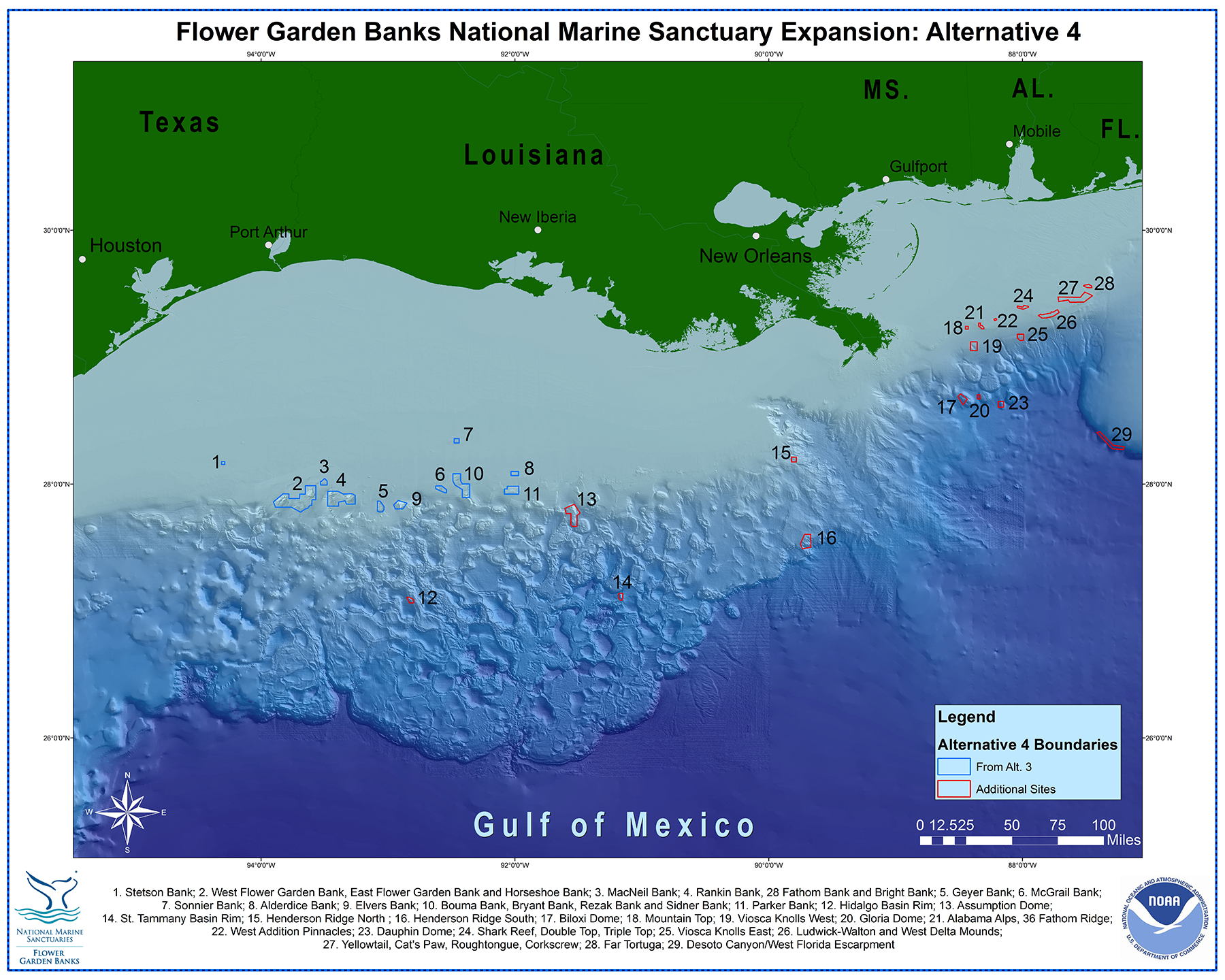
Alternative 4
Adds protection for high priority mesophotic and deep benthic resource areas across the north central Gulf to the modified Advisory Council recommendation (Alternative 3), encompassing ~634 square miles. This alternative includes 43 nationally significant natural features (including 18 high priority mesophotic and deep benthic sites) within 29 discrete proposed boundary areas. Alternative 4 would require additional operational capacity beyond what is currently available for FGBNMS. (Click on map for larger view)
Alternative 3 - Preferred Alternative
Features Included
Download Summary Descriptions of the Proposed Banks
Total Area
~383 square miles
Discrete Boundaries
11
Alternative 4
Features Included
Total Area
~634 square miles
Discrete Boundaries
29
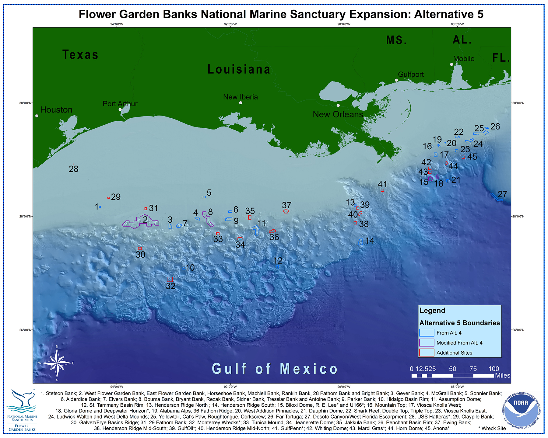
Alternative 5
More comprehensive management and protection of important and vulnerable mesophotic and deep benthic habitats, as well as important cultural and historic resource sites across the north central Gulf, further expanding from the modified Advisory Council recommendation and encompassing ~935 square miles. This alternative includes 57 nationally significant natural features and 8 nationally significant cultural and historic resource sites within 45 discrete proposed boundary areas. Alternative 5 would also require additional operational capacity beyond what is currently available for the FGBNMS. (Click on map for larger view)
Features Included
* = Shipwreck Site
Total Area
~935 square miles
Discrete Boundaries
45
Public Comments
NOAA accepted public comments from June 2016 to August 2016 through Regulations.gov, by mail, and in person during public meetings held in Galveston, TX, Houston, TX, New Orleans, LA, Mobile, AL, and Lafayette, LA.
Although the public comment period has closed, all of the submitted comments may still be viewed at www.regulations.gov under docket number NOAA-NOS-2016-0059.