STETSON MONITORING

Stetson Bank was first studied in 1974, but Long-term Monitoring didn't begin until 1993. Annual monitoring expeditions have been conducted by sanctuary staff and volunteers since that time.
The Gulf Reef Environmental Action Team (GREAT) initiated and installed the original repetitive photostations, and conducted the first six data collection cruises.
Repetitive photo stations are the biggest part of the this monitoring program. The purpose of these stations is to capture the same photo at the same place every year, for comparison.

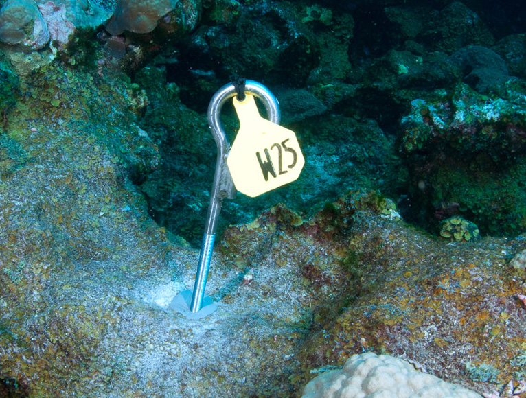
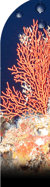
Pin marking a repetitive photo station.
(Image: FGBNMS/Schmahl)
Initially, 75 photostations were established. However, over time, some of these stations have been lost.
Stations are marked by metal pins embedded in the reef, with number tags attached. So far, this seems to be the best way to establish a permanent marker with little impact to the reef itself.

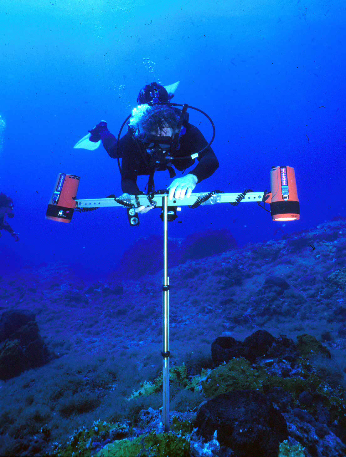
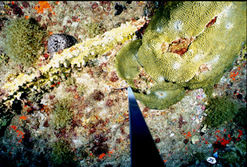
Photo: Joyce & Frank Burek
To make the photos the same every year, researchers developed a special T-frame on which to mount the camera. The camera is mounted in the middle of the crossbar at the top of the ‘T’ with the lens facing toward the ground. A compass, level and camera flashes are also mounted on the crossbar.
The base of the T-frame is placed at the pin location. The frame is rotated until it is facing north, the frame is adjusted until the bubble is in the center of the level, and then a picture is taken. This system allows the researchers to capture the exact same area in the image every year.
MONITORING PROCEDURES
Since each diver participating in the research effort has a limited amount of time he or she can stay underwater, work is conducted in shifts. Each dive team has a specific task to accomplish so that the next shifts will be able to make the most of their bottom time (time underwater).
A typical monitoring expedition goes something like this:
Shift 1: Lay measuring tapes on the bottom starting at buoy moorings and swimming out on predetermined compass headings for specific distances.
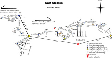
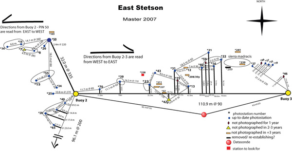
Click on the map to see a larger image.
Shift 2: Locate monitoring pins using tape transects and underwater maps for reference. The maps show distances and compass headings from the tapes to pin locations. Relative location of one pin to another is also noted. Even so, the pins are often difficult to find thanks to continuous algae growth.
Scrape algae and other growth off pin tags as they are located so numbers can be seen. Mark pins with weighted lengths of white floating plastic chains (18”). The chains float up into the water so the pin locations can be seen at a glance from much farther away.
Shift 3: Take photos at all of the marked pins. The photographer can quickly move from one station to the next by simply looking for the floating chain markers.
Collect chains as photos are taken.
Shift 4: Remove transect tapes.
Move boat to another buoy, and repeat!
top of page
MONITORING CHALLENGES
Of course, no system is perfect! When this system was first established we didn’t have digital cameras, so film cameras were used. This means that the researchers were unable to tell if their images were captured correctly until they surfaced, returned to shore, and had their film developed. Then, if any of the pictures did not turn out, the researchers would have to return to the site and take all of the photos again.
Once digital cameras were available and affordable, there was concern that the use of a new camera would result in photos capturing a different size area. So, it was decided to continue with the existing film camera set up until further notice.
Unfortunately, in 2007, there was some kind of camera failure during both East and West Bank and Stetson Bank monitoring trips resulting in no usable photos. Both trips had to be rescheduled and all stations re-photographed. On the return trips, the film camera was used again, but researchers also experimented with a digital camera as a replacement.
In 2008, researchers spent time in a pool trying out different digital cameras and lenses in conjunction with the T-frame to determine optimum settings. By capturing images of a research grid placed on the bottom of the pool, we were able to arrive at a combination that would closely match photos from previous years. As a result, Stetson monitoring 2008 went 100% digital!
So, what other challenges are associated with this type of monitoring project? As with any project at sea, weather and sea conditions are always a concern. Researchers schedule the monitoring to take place in the same month each year, but that doesn’t always mean that is when it will happen. Mother Nature may have other ideas.

Rescheduling the trips is also a challenge because they depend on availability of both staff time and a research vessel to get them there. Vessel availability has improved since the sanctuary got it's own vessel, the R/V Manta, in 2008.
Once on site, equipment failure and lighting conditions may affect the quality of the photos themselves.
The researchers really need to manage time and materials so they are as prepared as possible when the next monitoring opportunity presents itself.
MONITORING LESSON
We have also developed an educational lesson using actual photos from Stetson Bank monitoring efforts.
 Download Reef Monitoring Lesson (636kb pdf)
Stetson Monitoring Images for pins 26, 37 and 40 are available for use with the lesson.
See what other lessons are available by visiting the For Teachers page of our website.
top of page
LONG-TERM MONITORING REPORTS

The most recent long-term monitoring reports for Stetson Bank can be found on our Science Reports page.
top of page