MOHAWK ROV

The National Marine Sanctuary Foundation funds expeditions and initiatives that greatly enhance research, monitoring and restoration activities in and around Flower Garden Banks National Marine Sanctuary.

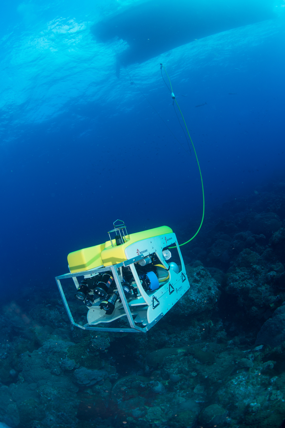
The Mohawk ROV on its inaugural run at
East Flower Garden Bank. Photo: FGBNMS/Schmahl
In 2013, these efforts resulted in the purchase of a Mohawk ROV which will greatly enhance research and monitoring efforts throughout the Gulf.

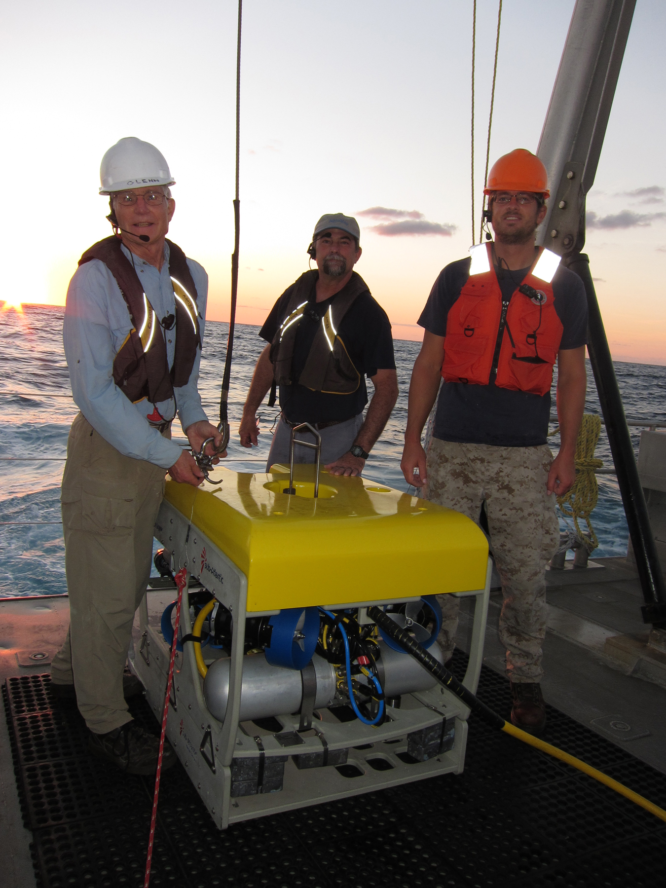
UNCW-UVP ROV crew: Glenn Taylor (left), Lance Horne (center), Jason White (right). Photo: FGBNMS/Hickerson
This vehicle will be maintained and operated through an innovative partnership between NMSF and the University of North Carolina–Wilmington’s Undersea Vehicle Program (UNCW-UVP).
top of page
ROV SPECIFICATIONS
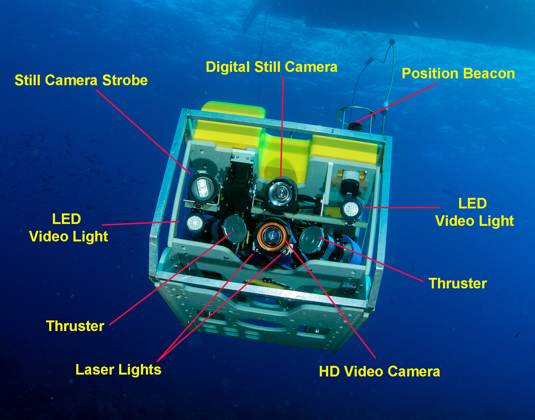
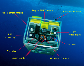
MANUFACTURER: Forum Engineering Technologies, Aberdeen, Scotland
DEPTH RATING: 1000 meters (3281 ft) - can be upgraded to 2000 meters (6562 ft)
Click on this image to see a larger image.
CAMERAS: Insite Pacific mini zeus HD video camera, 10x zoom; Kongsberg Maritime OE14-408 10mp digital still camera, 5x zoom; OE11-442 strobe with E-TTL metering
LIGHTS: 2 Bowtech 3200 LED dimmable lights, 3200 lumens, beam angle 80 degrees
LASERS: 2 Sidus SS501 50Mw green (532nm) spot lasers (10cm apart) - used for size reference in images
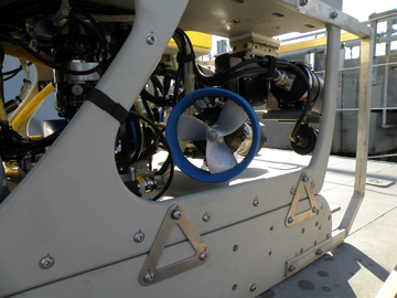
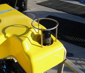
One of four horizontal thrusters. Photo: FGBNMS/Drinnen
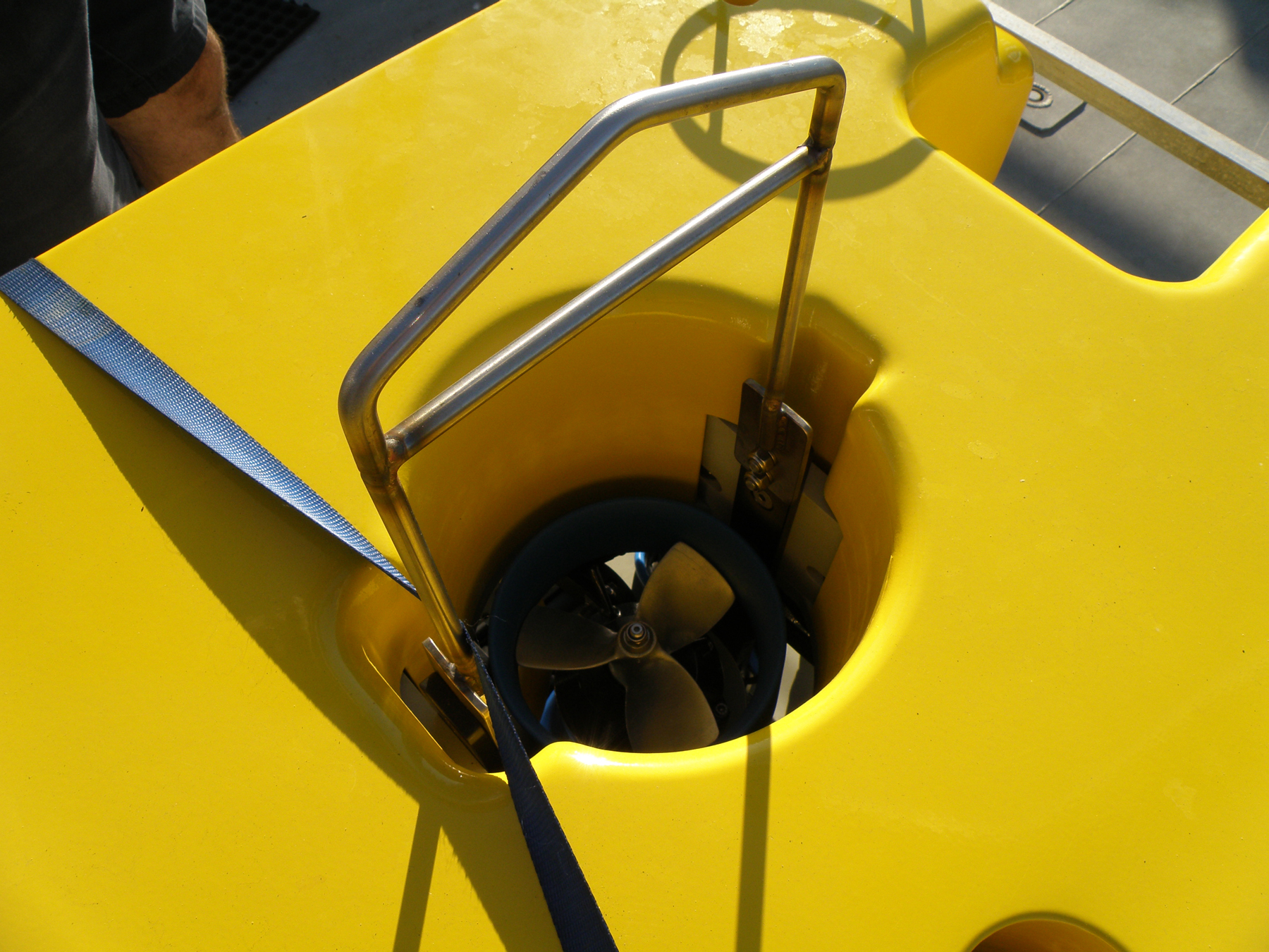
THRUSTERS: 4 horizontal CTE-01, 1 vertical CTE-01 with tandem props

Vertical thruster as seen from the top. The metal frame above the thruster is the attachment point for a hoisting cable.
Photo: FGBNMS/Drinnen
MANIPULATOR: CSIP micro 5-function electric (not pictured)
COLLECTION CAPABILITIES: A custom collection carousel and open/closing storage box is in development by Harbor Branch Oceanographic Institution and will be available for use mid-2014.
top of page
ROV OPERATIONS
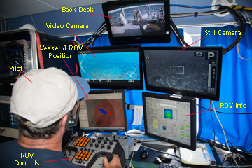
Click on this image to see a larger image.
SONAR: Imagenex 881 sonar
This position beacon lets the boat know where the
ROV is located. Photo: FGBNMS/Drinnen
ALTIMETER: Tritech PA500/6-S
TETHER: 365m fiber optic
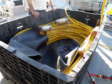
The umbilical must be managed carefully to avoid crimping any of the communication lines inside. Syntactic foam floats provide buoyancy in the first part of the line so that it floats up and away from the ROV underwater. Photo: FGBNMS/Drinnen
OVERLAY: depth, heading, altitude, number of 360° turns, date/time
NAVIGATION: ORE trackpoint II, ORE transponder, KVH compass, Northstar 951x DGPS, Hypack software provides tracking and geo-referenced video and digital stills
top of page
DATA COLLECTION
The science team sets up an annotation station in the galley of R/V MANTA during all ROV trips. This is where they watch a live feed from the ROV and record information about the organisms and habitat they see, as they see them.
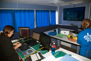
Marissa staffing the annotation station. The three monitors show (left to right) ROV position, a spreadsheet for notes, and the still camera feed. The large screen TV on the wall shows live video feed from the ROV. Photo: FGBNMS/Schmahl
Annotation creates a preliminary record of each exploration to use as a reference for more detailed research later.
The first HD images of deep habitats within the sanctuary were collected in this manner during the ROV's inaugural trip, October 28-30, 2013.
top of page